A bike tour in the Alps seems to be curious because most bikers prefer flat areas for their sport. On the other hand the Alps represent one of the most imposant countryside of Europe. So let it be a challenge for a great adventure.
The bike-technology was in progress during the last years. We now have the "Mountainbike" having good brakes and gears pushing the biker uphill. (Later I found out that on normal roads a light-weight racing bike is more convenient). If one stays at a steady station and starts tours in the surrounding areas a mountainbike is more universal.
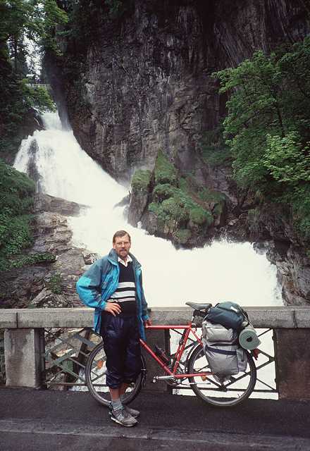
Well, we own a red coloured mountainbike of Kettler, Special Edition, this must do it.
The plan to go to the Alps has it's origin in the last year trip to Hungary: Passau - Wien - Plattensee. The Alps were often to be seen aside our route and my eyes got wide. Having 4 further members in my family - a dog in addition - you must use another trick: talk early and often of such a nonsense until everyone is used to it. Then buy roadmaps and study the route. It is funny, that you always figure out the first day. This is a certain psychological effect for you wait for nothing more than the very first day.
I didn't try to find anyone else for companionship, I told of 'nonsense' before and therefore didn't dare to ask someone for cycling in the Alps. There are several advantages in going alone: you are completely free, nobody can wish you to hell after any desaster, you can push or be lazy as you like - and so on...
Besides that you have a more intensive experience of all impressions on the tour. For I cannot share these things with any partner I made fresh daily notes and afterwards wrote down the memories to preserve them over the years.
After many sunny weeks this morning a pouring rain comes down. Well I have some time yet to prepare the bike, to assemble the panniers etc. At 9 am the rain lets up and the first and nasty part begins along the big ringstreet (Margaretenguertel etc.) with too much traffic. Out of Vienna along the Voesendorfer Strasse, at it's end there begins a signed Biketrail to the south of Vienna. Unfortunately after the big rain this is somewhat wet and softened. As usual I soon miss the right direction and find myself at Traiskirchen. (In the neighbourhood there is a locality named Gumpoldskirchen, you may figure out what makes this name famous)
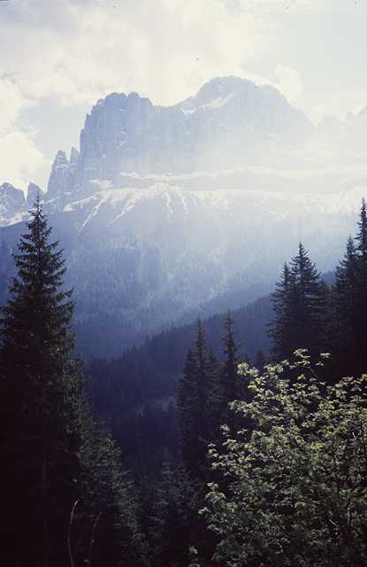
The nexst stations are Baden, Bad Vöslau, then there is the first hill up to Pottenstein. Nothing to be seen of the Alps, the clouds are hanging deep upon the mountains.
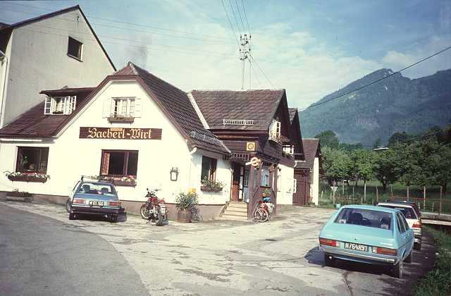
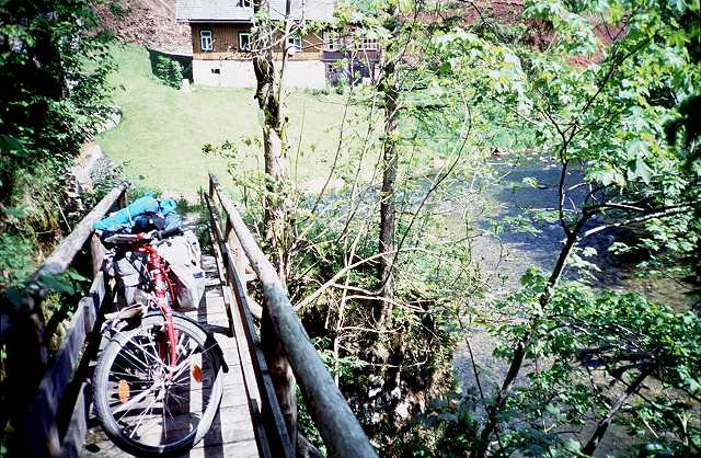
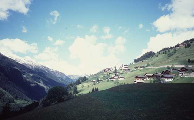
Now up a valley to Pernitz, there is a saddle with 650 m altitude. It rains again so during the descent I get pretty cold. At a bus stop I must change my clothes and warm up. I go on to Gutenstein at the Klostertal, then there is a second pass with 765 m height. Finally there is a descent 7 km long to Schwarzau im Gebirge, we have 5 pm and right away I find my accomodation at the Bacherlwirt. It is a very original inn - as you would imagine one if you dream of the Alps. So the first day, which was not only enjoyable, ends fine.
In the evening I make a final visit to the local National Park. The inhabitants of Schwarzau seem to be very proud of it.
At the next morning I pay for dinner, bed and breakfast DM 20.-
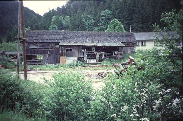
Sawmill in the Klostertal
The Bacherlwirt
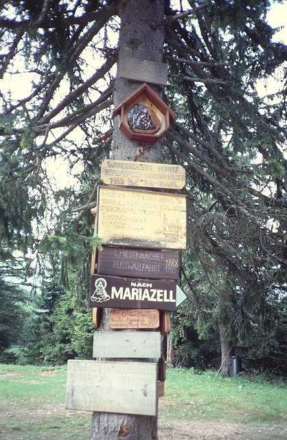
Now there waits a uncertain piece of way before. The origin of this intention stems from those very first plannings I mentioned above. Dozens of times I had taken a glance to the maps if this way would work. One can save 30 km on the way to Mariazell crossing a hill named Gippel - if it would work. At the inn they told me, some crazy folks had done it, but it should be necessary to carry the bike.
At first there are no problems. The way is paved by asphalt. But then there must be crossed a valley, so the capital of height is lost again. Leaving the last houses behind (Gasthof Triebel) a steep ascent begins, the way is of rough gravel. Step by step again you can push it.
But then there is a fork: the fine way leads to nowhere and the small and much steeper way leads to Mariazell as to be read on the signpost. It's a pilgrim path to pay for sins and evil things one did in the past! So do I !!!
You can read of it on the boards nailed at the trees, offered by former pilgrims. Did they have a bike and heavy panniers like me? I can climb some minutes, then I have to stop and breathe down. One hour at all, then there is more light amongst the trees and a sweet and soft way across the saddle and a meadow. Some wooden houses are lonesome places.
The altitude of the summit is 1134 m, I am proud to have made it, the first time above the 1000 m limit.
Boards of the pilgrims
Kanalröhrenmarterl
Now the path runs down on a comfortable forrest trail to the Lahnsattel, 1000 m. This place got it's name from a desaster during the last century, a big landslide. You can read it on a commemorative stone: 10 victims. Some racers pass by, my outfit is not theirs, so the greetings are short.
The next 15 km run down the Halltal. I have time to think of this morning and it's strain. How far will my tour go if this style will be preferred further on? But in the moment I am running fast towards Mariazell. The next sensation is waiting...
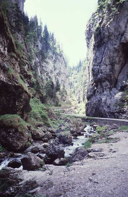
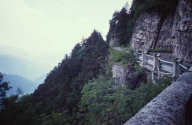
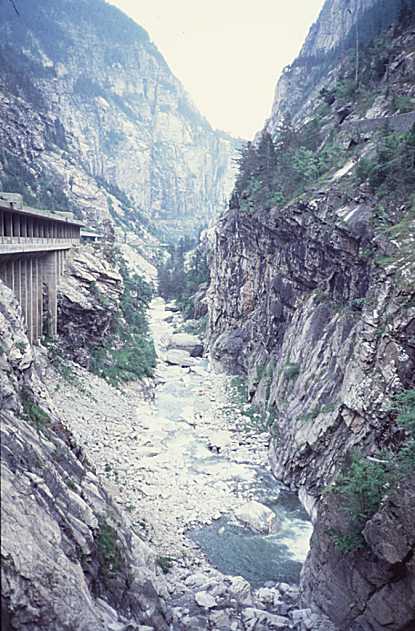
The exit of the Klostertal is blocked by the Salzaklamm (gorge). So the street winds up again to reach over the hill. But not me. I enter the gorge - my favourite pilgrim path again. "At one's own risk" is to be read at the entrance. And the place is so nice, you MUST get curious of the continuation. Besides that you can avoid the hill.
First across a bridge, then among and over rocks, up natural stairs, and suddenly I find myself 25 m vertical above the waters. Now I must carry the bike, cautiously climbing down I reach the ground again. Sweat runs down on my face and body. Now there is a signpost, it points out three directions: Klammweg that's where I come from, Klammweg that's where it's going on, and the third is Mariazell, a very steep trail up the hill I wanted to quit. But the way is wide and fine now, so I go on in the old direction.
Soon it ends. The path is winding up again in narrow hairpin turns, hard to carry the bike around the bends. 50 m higher the path continues, I must give up. What to do now? I must climb up just that hill I wanted to avoid!
Entrance of the
Salzaklamm
The Salzaklamm
On the way up I must bend the upper part of my body nearly horizontally to push the bike. Stops again to breathe down. One long hour. Then there are devices of a fitness trail, so the next road cannot be so far. And so it is.
And there I find out the consequence: Mariazell is located just upon this hill. It is 1 pm. All the time before noon I have spent for just 30 km. Many tourists around here, are they all pilgrims? I buy some food and drinks and do not feel well at this crowded place.
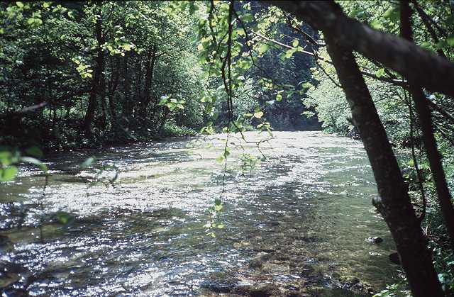
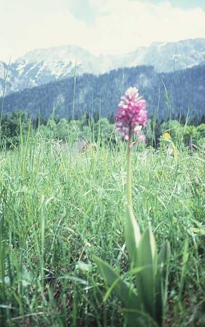
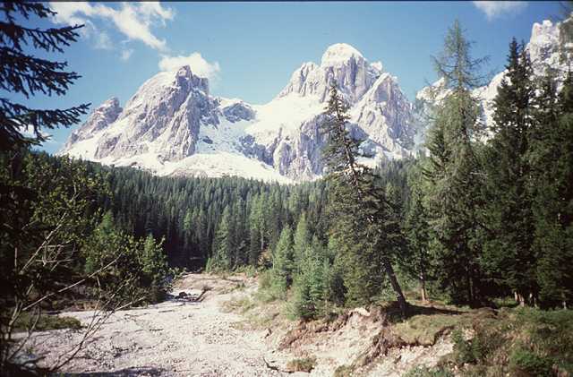
Now I head for 50 km down the valley of the Salza, my favourite. The weather is great, the landscape is a permanent delight. Many photos, water from the wells, river rafters. On the left there is the Hochschwab and his wild brothers, the characteristic mountain of this site. Here are the Alps and I can see them. Everything is in blossom, even more orchids. Not much traffic on the B24, many say hello.
Some stuff of a painter
Orchid and Hochschwab
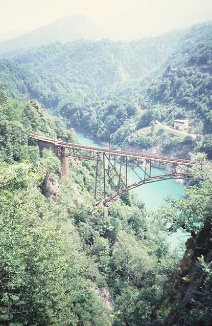
I pass the village Wildalpen, a center for river rafting. At Palfau a romantic road leads to the Ennstal. A construction site of a high bridge represents the domination of technical power over natural structures. But this will be seen more often further on my way.
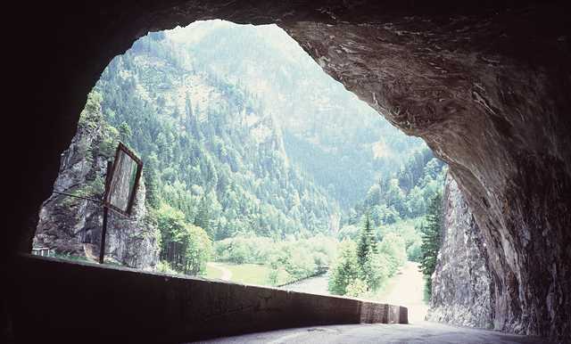
A Tunnel
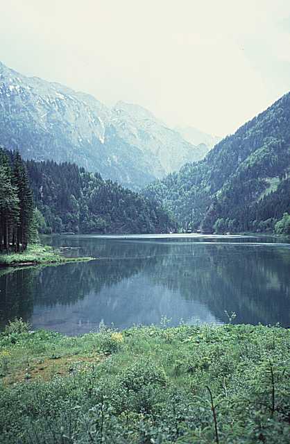
Water reservoir of the Salza
At 7 pm I arrive at Hieflau, where the Gesaeuse begins, the canyon of the Enns. It's my destination today though not so nice with wide streets. The only inn does not look fine. So I throw a glance at the information board and find a pension outside the village. This means another 15 minutes up a hill. Voices and music are to be heard long before - seems to be something like a Disco. But I get my room, my beer and sausages in the evening.
The panorama of the balcony down to Hieflau is very picturesque. My bill the next morning is DM 25 altogether, so I am very content with this place.
Start at 8 in the morning, the weather is not as good as yesterday. The mountains are hidden by clouds and fog. Now I pass the Gesaeuse, the Enns breaks it's way between Ennstaler- and Eisenerzer-Alpen. Sometimes this is very impressive, as the wild waters rush over huge blocks of stone. At some places this wilderness is killed by a dam where the waters are used to produce electricity. Some more construction sites and a tunnel. Inside of this I loose my orientation, the lights of the bike do not work - as usual. So I follow a car as fast as I can and soon arrive at daylight again.
The upper valley is wide and friendly up to Liezen. I find a smaller road for a while but soon I reach the Bundesstrasse again with more traffic. There is the Bosrucktunnel nearby bringing my motorized friends from the north (Linz area). But the wind blows from behind from the eastern side, that doesn't bother me. In Liezen I take a rest but don't find a comfortable place, too much industry and modern buildings around. Now I have to ride on the wide racelike road up to Trautenfels. There is a remarkable sign besides the road:
Liezen - Trautenfels
The Greatest Cemetery in Austria
Now I have to speculate about this matter for a while. Why that and where is the cemetery? Another sign gives the solution:
100 killed in 10 years
I try to avoid this road as often I can and pass the villages aside. In Trautenfels there is the junction with the road up to Tauplitz and Bad Aussee. The same story: a wide road and sometimes a village with parts of the old road. I don't feel good now, a little drizzle, cold wind from ahead and the street slightly going up. The last stretch to Bad Aussee runs down again, but now it is raining and I have to change to warmer clothes, long trousers and even gloves.
At Bad Aussee time is 3 pm and I am hungry. I had no real meal since the last day except those sausages at Hieflau. There is an inn and I get a "Krautwickel" (cannot translate, somewhat like "stuffed cabbage"). The Krautwickel disappears in a few minutes.
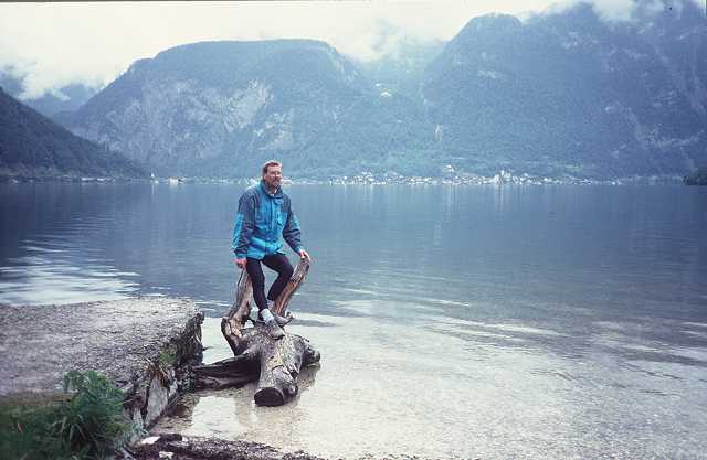
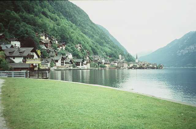
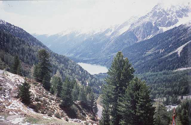
I am regenerated. A nice section lies ahead, the Koppenpass, the famous Koppenbrueller Hoehle, and Obertraun. A jump to the Hallstaetter See. A couple, married or not, comes out of a caravan and they make a picture of me, standing on a piece of wood above the water.
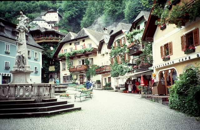
Hallstatt looks like a doll's village, everything clean and polished, flowers at the balconies, no traffic at all (that is lead beneath across a tunnel).
I was here 30 years ago and now have romantic feelings. In the moment there is no main season, so the location can be enjoyed more individually. The Dachstein, a famous mountain around, is hidden by clouds. The Dachstein Mammut Hoehle, one of the greatest caves in Austria, must be left on the left side above - no time!
250 m way up to Gosau are waiting yet. It rains again but I am in a good state now. My accomodation is the Brandlwirt, comfortable room and a good restaurant. Some tables away some seniors celebrate the traditions of the Alps in singing those strange songs as we say "Jodeln" (no translation). I am tired and soon go to bed.
I ride up the Halltal to St. Martin. But my own name doesnt't help: a strong rain breaks down and I have 20 km descent to the Salzachtal in this shower bath.
A bus stop again is the shelter for regenerating. My jacket of Gore Tex which was expensive has proved it's usefulness: no wetness inside. On the busy road I go up the Salzachtal but it will not stop raining. I must revise my plans, no Hochkoenig (the first mountain I climbed in my early days). Perhaps St. Veit instead, which lies just in front of me. It was my first holiday in the alps 30 years ago and we stayed at St Veit.
OK! That's it! Let it rain, a warm bath, some sleep, a book, a cafe, fine dinner: all things worth living. And see St. Veit again - I am highly motivated now.
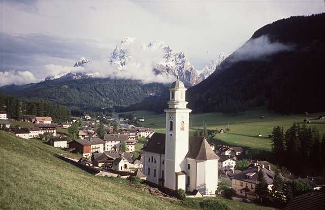
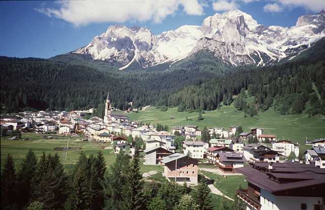
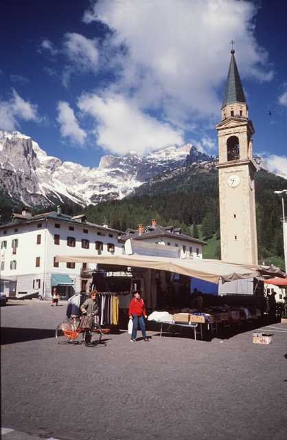
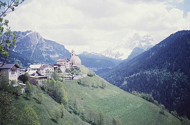
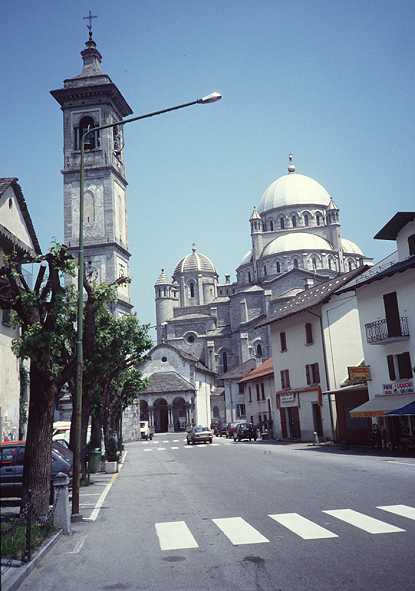
St. Veit lies 200 m up above the valley, last year they have built a wide ramp up there, not as romantic as the old winding road. At 2 pm I am there, at first a glance at the central place with it's strange church.
I feel quite at home. Asking at the first or second house I get a room at the very friendly family Freudenthaler and Haus Mariandl. And so it goes on: a shower bath, a coffee, a nap.
I ask Mrs. Freudenthaler for Leni. She was
the house daughter of the
restaurant Grafenhof where we spent our holidays.
May be I was somewhat
in love at those days with my fourteen years old...
Leni is now married to the Director of the local Bank and she is the
godmother
of the children of my family. So it is!
I go shopping but soon it gets brighter all around. What for I have a mountainbike? No panniers and luggage are needed and I find myself on an 8-10% ascent of asphalt way. It leads up to 1200 m then ends at the trail to the Schneeberg, 2000 m . The valley of the Salzach lies deep below, but the snowloaded Tauern as well as my favourite the Hochkoenig are still behind the clouds.
One hour ascent, 10 minutes descent. I would have even been faster, if there not have been such intolerant cows on the way.
My dinner is Tiroler Rumpsteak decorated by a portion of calamares (octopus). I wonder in what Tiroler waters they do find the octopus.
Another wide ramp full of traffic from Schwarzach leads up to the Gasteiner Tal, there is a long tunnel of 2 km first, but there are lights in it and a sideway gives room for a cyclist. At the end of the tunnel you find yourself at the beginning of the valley leading to the famous Bad Gastein.
But the first village is Dorfgastein. Here I was 25 years ago and made the first experiments in skiing. We had lived at the smith, the name of the family was Gstrein. Meanwhile there is a studio for arts and crafts (Kunstgewerbe). I see Mrs. Gstrein on her balcony shaking beds. I think they would not know me yet and go on.
Over a smaller road I reach Hofgastein. There are many disabled persons on the streets, for it is a health-resort in this site. One inhabitant looks with interest to my bike, he once was to the Zillertal he tells me.
The further way is nice, sometimes just aside the vivid Gasteiner Ache. The last passage up to the center of Bad Gastein is a steep road. Famous names are to be read who have made their cure here, I think about it as I read the name Bismarck. If one of those has pushed a heavily loaded bike at his arrival, clothed in sportswear?
Some sweat has run when I arrive the center. In front of the famous waterfall I lean the bike to the fence and some friendly people shoot a picture of the waterfall, the bike and me (I should have pulled down the legs of my trousers first :-).
Beside the waterfall you can find some informations. The waters fall down over 300 m and spray negative ionisated stuff in the air. That's why all the guests come to this place and breathe the air. Another reason will be the high comfort of the classic hotels, but some of these seem to have seen better times. The Casino looks good. A Rolls Royce strolls around. A parking garage doesn't fit to this scenery.
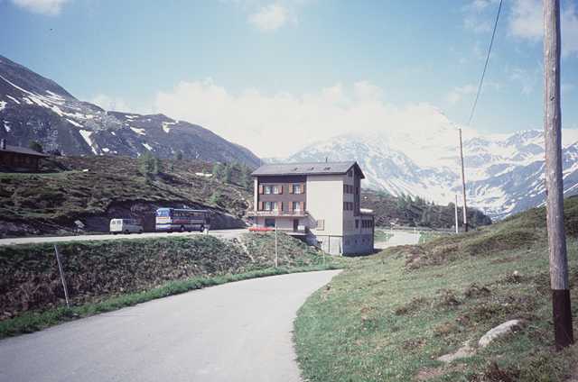
I make my way up to the railwaystation and buy the ticket for the tunnel to Mallnitz. But the next train will go not before one hour later. They tell me that there is an earlier train from Boeckstein 4 km away in 20 minutes. So I hurry up one eye on the speedometer. 5 min. before departure I arrive at the platform and jump into the train. 5 DM for 8 km and 5 minutes darkness. Then you arrive at Mallnitz on the sunny side of the Alps. And so it is, the sun is to be seen at least but erverything is dry. The wind is cold and the mountains behind the clouds as well.
The descent leads into the valley of the Moell, I must stop for a while for a slow van blocks my way. But at more than 60 km/h tears in the eyes make it impossible to run faster. The next 30 km up the valley of the Moell to Winklern. The route of the Glockner joins at this place. Well, there I am anyway.
Before I start for the Iselspass I enter a petrol station and put some oil on the chain out of an old can. Now up to th 1204 m height of the summit. I can ride it without pushing the bike. Something new! On the top there is beautiful sunshine, the Lienzer Dolomiten in front steam from the fog. The best place to watch this scenery is the Iselsbergkapelle.
Down 500 m to Lienz at the Drau. Much traffic in the town and on the road to the Felbertauerntunnel. I cannot avoid this part to reach the Defereggental. Soon I find a nice way aside the bank of the Isel leading 10 km to St. Johann im Walde. Only some cows bother me but I stay alive.
At St. Johann there are exactly 4 houses. The first pension is booked up by Italian fishermen who catch trout in the Isel. At the second house the woman is very kind to me and offers a room beneath the roof which is not completely furnished. But I don't care and am glad to have a home for this night.
The best is the meal for dinner: Pasta Chiuta and a huge portion of salad. One beer in addition and I feel like a balloon. So a walk does help, I even find a telephone to call at home. Finally I have a nice dialog with my host woman as I write down the impressions of the day (it's not as nice in English as it is in Tyrolian): "Oh I think you are a teacher?". I explain my work at the university at the computer center. "Oh then you are a teacher anyway!". Her husband looks something strange, may be I exterminated all his food stuff for this evening.
A steep way at first, but below there is the pretty gorge of the Schwarzach, so one should walk to look around (so do I). Everything looks like a picture-book. I climb up 200 m to St. Veit im Defereggental - one hour for this part. May be I should have stayed on the main road, anyway it is training. I buy a road map and some food, then down again to the valley.
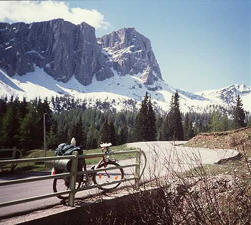
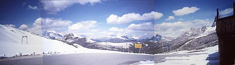
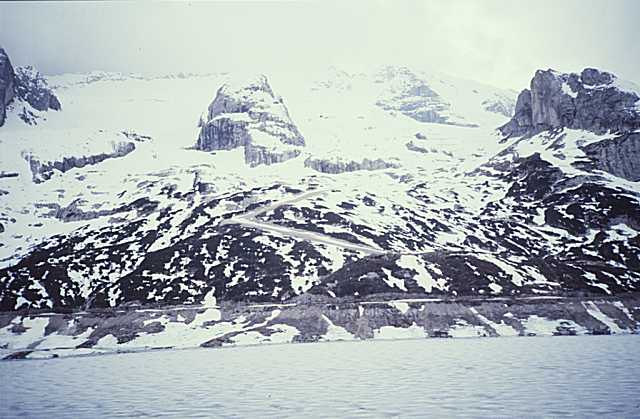
The highest pass until now is waiting: the Staller Sattel, 2052 m. Soon a biker passes me, he has a tiny backsack and a racingbike. He has made the Glockner pass the last day, but says it was dangerous with ice and fog. No mountains were to be seen. Comparing our equipment I feel like a trucker with my heavy stuff. Then he goes on and soon disappears around the next bench. Above the tree line you reach a rough area, the snow has just melt away.
Two motorcyclists from Duesseldorf who had passed me before, come back from the pass. I wonder if there is something wrong. At the summit for your clarity you can read, that on the road down the other side trucks, caravans and motorcycles are not allowed. The other thing is to wait half an hour to pass the frontier to Italy. Are the officers making a nap or what? The reason is, the road can be passed in one direction only and so they open it ervery hour. I have to bear a heavy shower of snow behind a stone. The thunder of avalanches sound from the walls around.
The officers have no interest in me or my passport so I enter Italia. The descent is very narrow in fact, you can hardly make more than 20 km/h around the curves. No traffic from the front so you can use all of the street. Down 600 m I reach a lake and the Antholzer Tal. The wind blows from behind and the street goes down, that's fun. 20 km to the Pustertal, but now dark clouds are threatening.
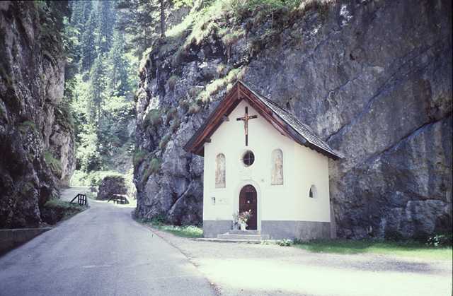
I enter a bank to change Lira. The officer feels sorry for me having bad weather all the time. So I feel myself and go on towards Toblach. I make a rest on a meadow and do not feel well. What is the sense of all this, rain and nothing of the Dolomiten around? But the show must go on, I enter Sexten just in time with the rain. The tourist office is open, I can look for a pension and prefer the neighbourhood of the church. Everything OK again, I order for two nights to make a rest at the next day. The weather forecast for the weekend is better. I have a good bath and dinner, so the world seems to be more friendly again.
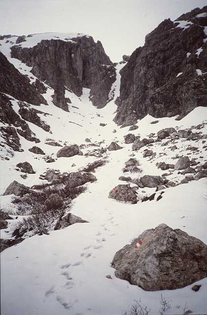
One hour later I reach the Dreischusterhuette at 1517 m. The sun breaks through, the peaks are still covered by clouds. As the path gets too rough I lock my bike behind a bush. There is a marked trail number 105 to the Dreizinnenhuette. There are no traps on the snow, so I am the first today. I know the dangers of the Alps in this situation, but I try the trail for it is easy to walk. Climbing up the height of the snow grows and the feet get wet soon. Suddenly a chamois (Gemse) stars at me, I as well. Will he attack me! But he does not and jumps away.
I now feel anxious, it is too lonely, if you break an ankle or so and no one around? The Dreizinnenhuette seems to be far away yet. Now the snow is too deep, I am stuck to my knees. That must be the end. I sit on a rock on my hat to preserve the cold from below. The fog is hanging around, sometimes you see the rockwalls, then they disappear again. A slight snowfall starts, I decide to return. With caution I slip down on the snow. The snowfall does increase, what's about my hat? Well: I have forgotten it at the rock above. What to do? I own this hat over years, there is some tradition combined with it. The love to my hat is stronger: 10 minutes back, save the hat and so I do. The feet are wet anyway.
Now with the hat at it's place I walk down again. Finally an older couple comes from below: now I feel safe. The man asks me for the way, I can tell my story. Then he asks for a result of the German soccer league, I must quit the answer.
Soon I am back down again jumping over the rocks. The bike is still at it's place. Upside there is more fog again, so back home. 10 minutes downhill, the wind blows into the wetted stockings and feet, they feel like ice. Back in my room I can regenerate and take a nap.
At 6 pm suddenly the best weather comes up. The sun is shining and the fogs pour down the walls. I leave my bike at it's place and enter a road leading straight upwards. And there it is, the great panorama, the sunclock from 8 to 12 am. At 8 pm I return, happy!
For these 6 km leading up 400 m I need one hour. At the summit new mountains come up in the south. Down again I reach Padole. This day the market is active. Language, houses, and the total atmosphere are Italian now.
Next up to the Pass St. Antonio, 1468 m, and then down to Auronzo 864 m. I must take a rest for the rears get hot from the brakes. Behind Auronzo there is a wide valley, at it's end there are the Drei Zinnen (so I think).
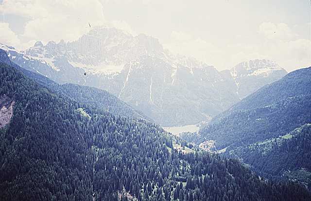
Now I enter this valley leading 1000 m up to the Misurina See and Drei Kreuze Pass. For the distance is long you come up step by step. In the valley all hotels and country houses are closed, they get alive during the season only. Not much traffic on the other hand and that is what I like. At the end of the valley just in front you see the peaks of the Cristallo.
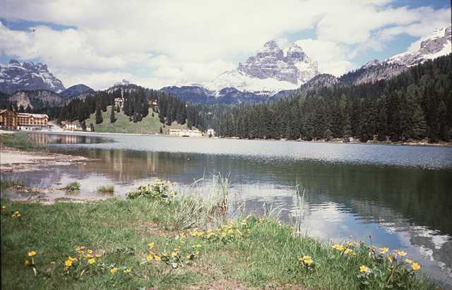
I walk and ride in turn, the speed nearly is the same in both cases. I try to find a trail which is marked in the roadmap, but it ends up in a creek and a muddy area. So I enter the road again to see the famous lake of Misurina. The big hotel seems to be a home for children meanwhile. Some busses, the people walk on the comfortable way around the lake. Pedal boats are available. A German couple leaves their car, the wife enters a meadow and shouts: "Hi Korl (Charly) this is gentian (Enzian) around here!". Then they take their shots, so do I and make pictures of the scene, the Drei Zinnen (now they really are in place) decorating the background.
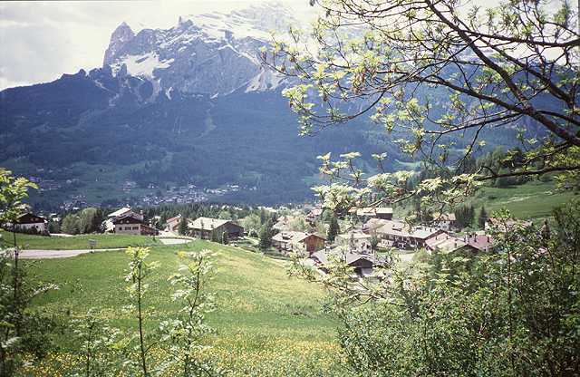
At least after I have consumed my sausage (Landjaeger) I go up to the Drei Kreuze Pass (Tre Crocci), 1809 m. Now the mountains of Cortina make the scenery, in front the Tofana. The descent to Cortina is wonderful, the curves are wide and you fly down. It is 4 pm, but I cannot go on for there is no greater village on the further way behind Cortina. In the tourist office they tell me, no private pensions available, hotels only. Well I choose Hotel Montana just besides the church as well. Cortina is totally influenced by tourism, many shops and restaurants. I only need a Pizzeria.
At least I have some philosopic ideas of this evening. At home my sport fellows celebrate the yearly barbecue party in a former cow stable. And I stay at Cortina. What is the better party?
Misurina See
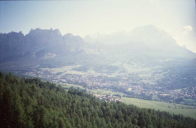
Cortina and Tofana
Cortina and Cristallo
I reach the fork to Pass Giau. My plan was to take this route at fine weather, no question today. Someone has lost his water bottle here, so I pick it up and clean it thoroughly. You can find clean water at many wells aside the road or directly from a creek - but there you never can be sure of the quality of the water. I use drink tablets to make the water tasty.
Walking or riding I come up. At the tree line a black Mercedes comes along. It is from Hamburg and a former hearse (Leichenwagen). In the back part of the car there are to be seen pillows and beds, so the people sleep at the same place they formerly had the coffins ....
Up the tree line you have a free sight and the road is less steep. Two long curves lead among snow banks to the summit of the Giau at 2230 m. Three hours from Cortina. But now there it is: all the mountains I only know from the books: Marmolata to Sella. I stay for half an hour but a second pass waits today.
You need warm clothes for the next 1000 m downhill. Some stops again to warm up, the rears have to do the opposite. At the next junction I turn to the Colle Santa Lucia, a wonderful landscape all around.
At one place the village Rocca Pietore lies 300 m beneath your feet. I can look to the valley of Petorina up towards the Fedaia Pass. At the wall beneath you can see rare flowers (Kuechenschellen, Pulsatilla). The road to Rocca is closed, that would be a 30 km extra tour. But there is just a bus coming up, I think then I will success in coming down as well. No problems, at one place a rock big as a house (a small one) has fallen on the road. That is the reason why it is closed.
Santa Lucia
Pic 1
Pic 2 Rocca Pietore
Now I have three hours again for the second 2000 m pass this day. I go slowly and try to avoid the main street. At one village there are scenic wooden storage houses. High above there is a bridge where the main road crosses the valley. I wonder how I can come up there. And there it is: the big surprise. I find myself inside a canyon: the Sottogudaschlucht. This is the historic trail up the valley. You find all you want: big walls, a waterfall and a chapel.
At the end of the canyon I meet the main road again. A big cable lift goes up to the Marmolata, a ski tow (Schlepplift) runs up the valley. Several hotels do not look very romantic. But today there is no skiing and that is the better thing. I make a rest near some old wooden haystores and now can activate my phantasy. I imagine those former days less than 100 years ago when this dangerous trail was the only connection to the rest of the world. During the wintertime this place is a roaring ski center today, at those former times it was the end of the world.
The next passage of the pass is unpleasant. Steep without curves the road leads up like a ramp. Near the summit some hairpin turns make the end, they are better to run.
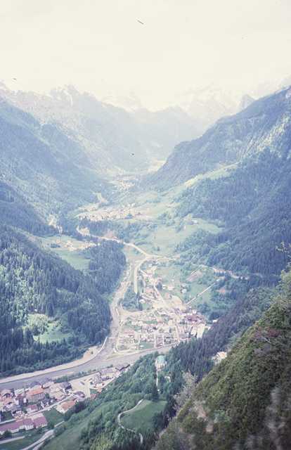
The view at the top is not as impressive, main reason will be the weather turning bad again. The Marmolata looks grey, the water reservoir is nearly empty. At the descent I get my difficulties in the tunnels again. Near Canazei in the Fassatal the rain begins. I ride some more kilometers to Vigo di Fassa. I get my accomodation and a splendid pizza at the restaurant La Grotta.
The weather above here is grey now but down to Bozen everything looks sunny. The descent leads down to 265 m. It's a great run and you see Bozen from above. Down in the valley there is much traffic. There must be place for the highway, the main road, the railway and the poor river named Eisack.
At Bozen I meet the summer. A telephon call at home and that's it, too much mass of people around. I try to ride towards the Mendelpass (Paso di Mendolo). At a kiosk I ask for the way. A man with a moped explains the way with many words and gesticulations. At least I now know the next two junctions of the way. Just after the departure the man with the moped passes by and explains, I just should follow him. But my bike is no moped and he drives more than 30 km/h. But I can stand it, at the traffic lights I can breathe down. Finally he tells me, he is living in this street, I now only had to go left and then straight ahead. "Passo Mendola much road" is his last advice. I say thanks and good bye and leave Bozen.
Furthermore I reallys find much road and traffic. I am on the Suedtiroler Weinstrasse towards Kaltern (there is a famous wine named "Kalterer See"). The sun is burning now, and riding slightly uphill the sweat runs into my eyes. Another problem is a cracking sound at one of the pedals, but some drops of oil from another old can at a petrol station help. Finally I reach the junction to the Mendelpass, no more heavy traffic and a rest. A group of youngsters with mountain bikes is coming up, they take a rest too. Now it's my time to go on, I enter the bike and start climbing in an elegant fashion. I am aware to jump off the bike behind the next curve and to start walking. But it works, I find my rhythm. But the road is not so steep and leads through the forests in the shadow.
Then I reach an exposed ramp blasted into the rockwall. Now I walk to have a better view down to the lake of Kaltern. I dream of the red wine down there. The rest to the summit is no problem, I have made 20 km from 260 m up to 1000 m. On the way I was wondering at the many bikers running downhill, now there is the solution: someone drives up by car and the sportsmen unload their bikes and run downstairs proud of their racing dress.
We have 4 pm and I can make some distance yet. A descent to the wide valley of the Rio Novella. From the right a canyon comes down, I stop at a bridge and peer over the fence. Such a sensation I never saw, there is a 50 m deep canyon completely dark at it's ground. At the next bridge the same view, and from now on I suffer from the desire to stop at every bridge. After many harmless creeks the desire gets moderate again.
Some small showers of a thunderstorm are coming up. I enter the entrance of a house for shelter. I miss to notice this is a Carabinieri Station. At once an officer comes out and declares in an resolute fashion this would not be the right place for me. Well, the rain stops anyway and I roll on. But one feels something strange for most people on the way usually are very friendly to cyclists.
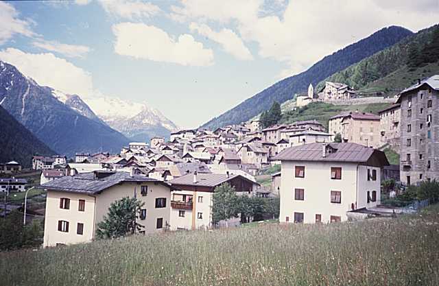
Another gorge at the Lago di St. Giustina an then I enter the Val Melecchio di Sol leading to the Tonalepass. It is 6 pm but there is a nice backwind and it is pretty warm. I go on one more hour to Male where I hope to find my accomodation.
I pass some hotels which look expensive. Then I stand in front of Hotel Puller, this looks more modest. In the entrance there sit a lot of elderly women. I pull on my long trousers to look better and enter the house. Everywhere elderly women sit and chat. May be I entered a Senior Home or something like that?
Two of the elder women seem to be the managing directors, one of them speaks some German. They are extremely kind, of course I can get a room, at 8 pm will be dinner time, they will call me up. I feel wonderful. As I enter my room I break out in laughter. But I must hurry to take my shower bath and change to a convenient dress. Then the telephone rings: "Dinner is Served" they tell me.
I find myself in an old fashioned dining room with crystal lamps and antique pieces of furniture. The dining tables are set thoroughly by tableclothes and serviettes, different wine glasses, bread basket etc. All the elderly women sit at their place and chat. Some elder men are to be seen too, but they don't chat, may be they have given it up. I got my place, two waitresses serve the meals. Soup at first. Then I make something wrong when they ask for the drink. Though I dreamed of the Kalterer See this day I ask for a beer. That seems to be unusual, they run in several directions first to find a bottle of beer, then to find an opener. At least they pour out the bubbling beer on the ground and must run for a wipe cloth.
Finally I can enjoy the steaks, potatoes, bread. At least they offer cheese. I choose two well shaped pieces. As dessert they bring a portion of ice and I have difficulties to combine this with my big bottle of beer.
After dinner the complete society starts to a walk around the etablissement to get the metabolism (Stoffwechsel) in action. I go my own way. Next morning I have a splendid breakfast as well and pay DM 45.- altogether.
At noon I enter a lonesome ski center, sit on a bench and wait for the end of the rain. My enthusiasm has gone again. Warm clothes on and down the descent. There is Ponte di Negro, the sun is shining again. Furtheron downhill to Edolo, 700 m. The air remembers to summer climate. Up the next valley: Val di Corteno, narrow curves and the cars sound their horns before each bench.
I find a rock covered by small plants you usually find in rock gardens (I cannot translate: Hauswurz, Sempervivum). But I keep my bags closed, it's too far from home (of course you never should extract a rare plant from the nature, OK, OK..). I never found a similar place on this tour.
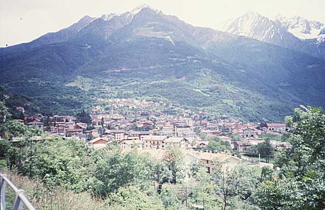
I hurry up to reach Aprica, 1175 m, before 4 pm for I must look for a bank again. I arrive in time but find no bank opened, the ski season is over and everything asleep. I use a bench instead to rest for a while. A long descent follows down to the valley of the Adda, 375 m. Within 30 minutes the 18 km and 800 m height difference have been put away and you are inside the Lombardian landscape with vineyards and romantic villages all around. The most astonishing thing for one coming down from the mountains is the sudden change in the climate: mediterranian, that means so much warmer than at any time before.
15 km to Sondrio, much traffic and the sun from the front - but the wind from behind. At 5.30 pm I arrive and I get a hotel cheap and simple. I make a walk, some parts of the town are from the Middle Age and look nice. In the center there is some horror: youngsters arrange races with their mopeds or Lambretta scooters, not as nice for ears and nose. In the evening there are 25 deg. C., summer again.
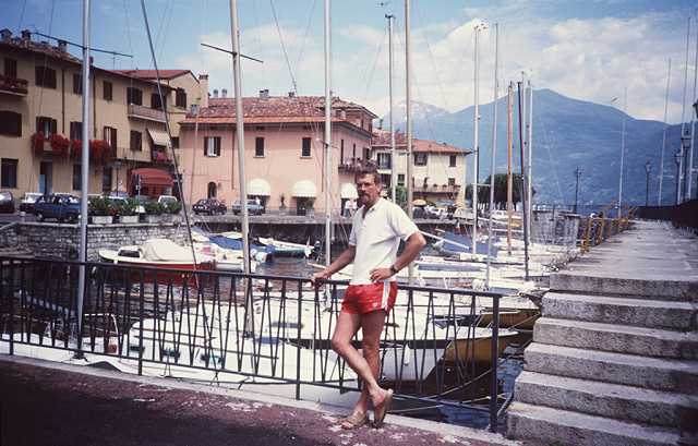
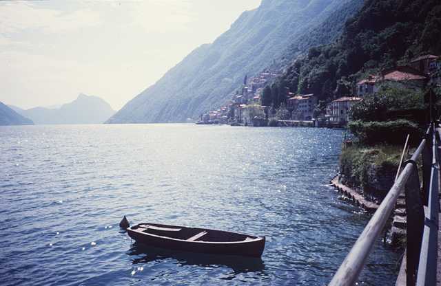
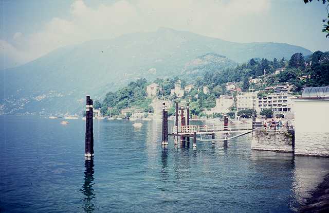
There is a pleasant small road besides the Adda with no traffic. I reach the Comer See, the landscape around is wonderful. At the shore of the lake there are a lot of tunnels, but they are short and make no problems. At Menaggio I leave the Lake towards Lugano. An elder couple from England is very active in shooting photos at the promenade. So I ask for a picture of myself and get it.
On the way to Lugano I cross the frontier to Suisse. Once I ride into a village leaving the main road (as usual) and find myself in front of a chapel, vis a vis to a russian monk looking like Rasputin. He sells those golden russian pictures, we say Ikone. The monk looks angry at me, I don't know why. I must go back for only stairs are all around to continue the way.
At Lugano I take a rest at the lake and feel exclusive as many people here. Banks are closed again so this time I have no Franken - the Suisse currency. Now during the rush hour I enjoy the traffic. It has completely broken down, I am the only one moving ahead on the right or left sidewalk. I reach Ponte Tresa and soon enter Italy again. At 6.30 pm I arrive at Luino, the final place for today.
I fight my way through the traffic of the rush hour and enter the hotel Elvezia. I get a very nice room, at the backyard of the hotel there is a palm-tree. At the evening I go to the shore of the Lago Maggiore some melodies of sentimental pop songs in the ear. I have made it now, the far end of my tour has come, the next days I must look to get home again. I watch the sunset behind the mountains and feel very happy.
At the dinner restaurant I forget my overall but get it back next morning.
Unfortunately it is hazy so you cannot enjoy the colours and views across the lake. As I pass the frontier to Suisse I now change money and can use it immediately. A ship passes by, I enter it happily. Now I have my voyage to Ascona.
I say Goodbye to the Lago M. and head for the Centovalli, a romantic valley. A railway is leading up there in an adventurous trail. Just at the best progress a red traffic light comes up, the main road is closed. You instead must go up 200 m to a small village and then make it all down again. No problem for the motorized road-users, but the biker pays by sweat and an additional hour of his time.
The next way is romantic as well, nice canyons and high bridges. At the summit to the next valley leading down again I take a rest. It is an error. To the summit there are 15 km more to climb. This is a psychological problem for you always wait for relief but must fight on and on. I once pass a village with a strange orientalic church. The name of the village is Re.
Finally you reach 800 m height, then you can run 20 km downhill. I pass a canyon but cannot risk a view due to the high speed. This valley is the Val Vigezzo.
At Masera you are down at 300 m height again and join the big European route to the Simplon. But not much traffic and I find myself at the mouth of a more than 2200 m tunnel. With a strange feeling I enter it. Is it possible to breathe poisened air in there? At the ceiling there are big ventilators, and what's about the motor-cyclists in a similar situation? But they pass the tunnel in a moment. But I calm down and finally see the sun again.
1100 m ascent to Simplon are waiting now. There is the railway tunnel to Brig, but this time I will do it for my own. There is the scenic Gonso canyon. So much to see that you do not notice riding uphill. In the middle of the canyon at a dark place there is the frontier to Suisse again.
In the gorge you sometimes see relicts of the old trail, artistic constructions of stacked rocks, bridges and tunnels. The old trail used the conditions of the ground and walls perfectly. Do not compare the modern ramp that is blasted broad and wide into the slopes. At many places they build roofs above the road to keep back avalanches and falling stones. So the cars can run up with 100 km/h and more. Does anyone enjoy the landscape yet? So they more and more destroy it!
I enjoy. I can stop where I want and can look around, upside or down. From the frontier at Gonso the last 500 m to Simplon will be managed. About 7.30 pm (4 hours ascent) I arrive. The first house of the village is Hotel Fletschhorn. There is someone in the garden and staying on my bike I ask across the fence if I could have a room. Sure I can!
At the summit you have a nice view to the Aletsch and the Berner Oberland, but the mountains show themselves never without clouds. I lie amongst the flowers and feel well. The descent is very long and leads 2000 m down to Brig at 678 m. The road is wide and the speed high correspondingly. Once there is a big bridge 140 m high crossing a valley.
Soon I am in Brig. This is located in the valley of the young Rhone and the area is called the Wallis. But much industry and traffic again. I want to go to Gampel and up to Goppenstein. There is a railway station for another transfer per tunnel to Kandersteg. From Brig I try to avoid the main road running zigzag at the banks of the Rhone. Somehow I reach Gampel. Two times I ask for the way up to Goppenstein. The roadmap shows an old trail leading up a canyon. They tell me, that the road is closed but you can use it at your own risk.
I try it. The street workers have their lunch break so no one can watch me when I enter the trail. I must crawl under a red and white barrier, there is a shield that nobody is allowed to use the road, inclusive pedestrians. Behind the next bench I run my own risk. I wonder for the reason why this road is forbidden. There are some rocks on the way as it is, if a road is not used. But it's made for me alone now and I enjoy to ride free of any traffic. High above there is the roaring main road.
Soon the galleries of the main road and the railway come near. Finally I reach a wide place, big piles of stones around. And there is a sign that tells, that this is a dynamite blasting area. The last curves of the trail I finish in a very sporty kind of cycling, one can guess the reason.
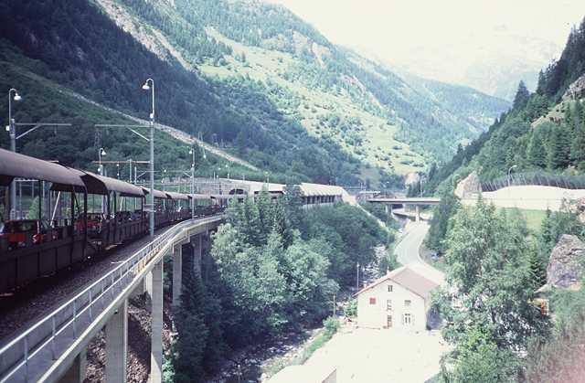
The last section to Goppenstein, I made up 400 m again. The next train is waiting, I enter the last waggon for motor cyclists, but I am the only passenger. The tunnel is 17 km long, you pay 4 SFr for the transfer. At Kandersteg I ride along all the car waggons and leave the train behind the caravan of automobiles.
Now I will leave the Alps running down to the Thuner See. A view back to the 3000 m mountains, in front there is a countryside as you know it from the advertising of chocolate or Suisse cheese. A ralley of oldtimers is coming up. At Frutigen I buy two sausages and a cheese at a nice store. They ask me where from and to. I am proud of all the way from Vienna. I sit on a bench, a sausage in one and the cheese in the other hand. People star at me laughing, so at last I recognize my appearance.
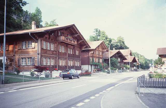
Near the Thuner See I dare the crossing of a final hill on a side road and reach Aesch and at least Interlaken. At Interlaken the rest of the world seems to have a meeting. I enter the shore of the Brienzer See. A nice road leads to Brienz, the last overnight station of this tour. I cannot find a private pension. But for the last night I may enter a hotel to pay some more but to have a balcony and view to the Lake of Brienz. The last dinner is a fine pizza.
So the last kilometers to Luzern are going downhill. I would like finally to use a ship on the Vierwaldstaetter See. I have reached the 1500 km on my tour, so there is no cause of shame. As I come near to the lake I see a ship just running off the shore before I can enter it. So I hurry up, may be I can reach it at the next station. At the next bench I see the ship coming in, when I reach the station I see it leaving off again. So I give it up. Two minutes too late after 1500 km!
The last 8 km at the base of the Pilatus to Luzern within much traffic. I enter the railway station at once. Look at the timetable, buy a ticket, change money, manage the luggage, send the bike back etc. After this busy time I sit in the train to Basel and think it all over, I cannot believe it. Now the tour planned over months is over and gone, but in the future I will have my memories.
At this final day I made the Bruening Pass in the morning and at 11 pm I am back home at Braunschweig!