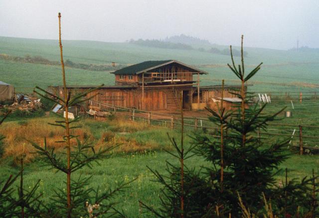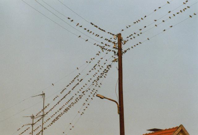
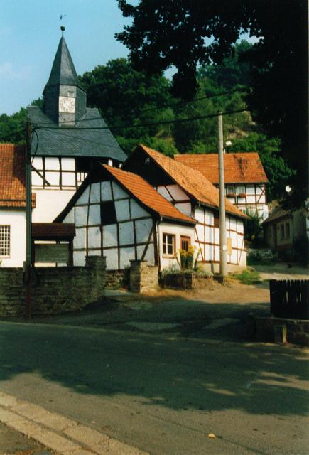
Swallows at Ilfeld
| Harz National Park | Karst Wanderweg |
| Back to the index | Back to the Home Page |
Appenrode (Ilfeld) - Wippra, 16.8., 80 km
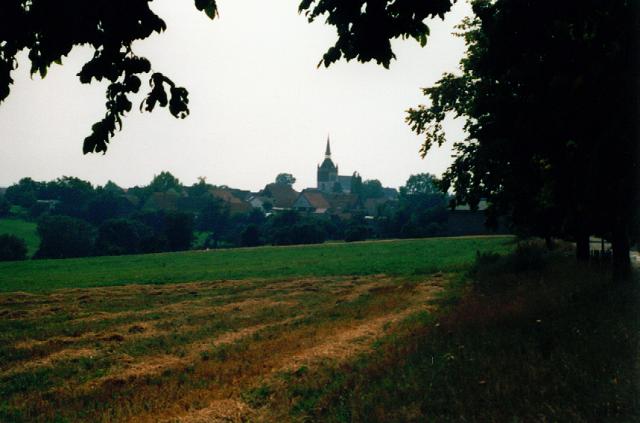
Just one week later there is a new occasion to continue the circuit tour around the Harz. This time I get up at 4.30 am. I had planned to start at Ellrich, but - may be still asleep - find myself at Ilfeld. May be the road from Rothesütte/Harz to Ellrich does not exist. The car is parked at Ilfeld and I argue how to start the tour. There would be a gap of 5 km between the former endpoint Appenrode and Ilfeld. For I do not want to neglect my reliability I decide to explore the road between Ilfeld and Appenrode and classify this as a morning-training-unit.
Everything is grey around, I pass a pond, then ride uphill through a forest and as the road gets steeper passing a flock of cattles which look stupid. At the entrance of Appenrode the road runs down again.
|
Swallows at Ilfeld |
Thereafter along the border of a wood, along the Krebsbach and up some gravel hairpins. The trail may be somewhat adventurous with its potholes or puddles. Finally down again and at some dams and pools we reach the L27. But you are not invited to use this fine road for the next two kms. The biker is sent by the witch uphill and on a muddy path. Up there is the new settlement named Rödishain. Then down again to the L27, but do not use the tarmac road but the parallel dirty track instead (so says the witch). So I feel somewhat like a mortified flagellant now. But now we use the L27 to Rottleberode. They have built a brand new sport arena there with English turf, tartan courses and floodlight.
Behind the railway station we turn off towards Alter Stolberg, and this is a small mountain nearby. At one side there are big quarries, the Knauf-Werke produce gypsum there. Soon we reach the main attraction of the region: the cave Heimkehle. We have been there 1990 as Christel and Reinhard V. had introduced impressively into these completely unknown worlds. At a signpost one can read about the origin of the cave: at the phreatic part of the gypsum formations the material is dissolved and transported away by the waters. The remaining cavities collapse and the new material is dissolved again and so on and so on. At its end the cave will reach the surface as we have seen at the Kelle the last time. The Heimkehle is one of the greatest Gypsum caves at all.
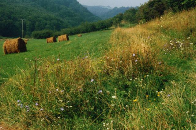
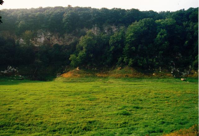
I cross the bridge of the Thyra and pass the Pulvermühle. This is or was a place of production of pyrotechnical products. Behind Uftrungen there is a nice unpaved and nearly traffic free road. Forests and meadows and a restplace so inviting that one really has to stop for a cheese sandwich. Behind Breitungen the next attraction is waiting and this is the Bauerngraben. On the right side there is a gypsum wall and so it must nearby.
 The Bauerngraben |
They tell the following story that is said to be found in the archives. When the drain holes of the periodic lake collapse or are blocked, the waters from the creek in this sink rise several meters. Eventually the blocked drain will be dissolved again and the waters can pour off, and this can happen very rapidly. Once the lake existed over years and the locals hat started to breed carps. But one day everyone had to wipe his eyes: the waters have gone and the carps with it. Some months later the waters have come back from the mountain and the carps too. But those were not eatable any longer.
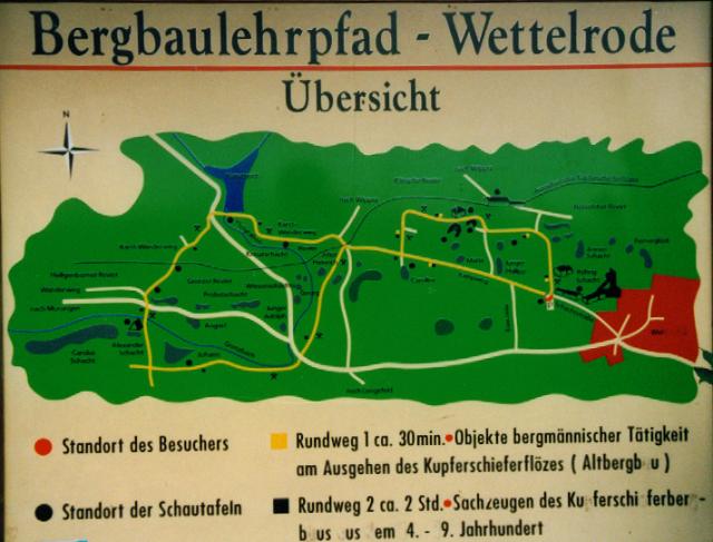
I say thank you to the friendly couple and dog and go on towards Questenberg. On this section I reach the speed record: 55 km/h. So I fly along passing the nice half timbered church of Questenberg and the fork of the bike path. At the end of the village I recognize the error and go back, take a photo of the church and follow the cycling witch, which will make me sweat at the next section. We now are on the Karstwanderweg with its informative signposts. Here we find drains (Schwinden) of the Hasel- and Dinsterbach, some time later there is a formation (Aufschluss) of Kupferschiefer (copper schist). After Hainrode there are curious little hills grown with trees, these are former heaps of small pits and are called Pingen.
 Questenberg |
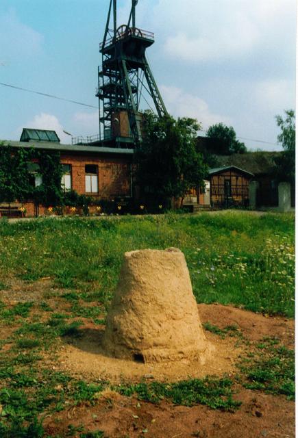
We pass Morungen with its castle. This seems to be built of red sandstone. And then I am soon at Wettelrode. There is the mining museum Röhrigschacht. In community with our witch we assemble at the parking site and have another sandwich. We have a view to the town of Sangerhausen, which is not only famous by its Rosarium but as well by the ugliest hill of the Harz. This is a big cone shaped heap of a former mine without any plants and to be seen from far away. At a signpost we can read some informations. In the year 1854 the miners had dug an adit from Sangerhausen to drain the waters of the Röhrigschacht. But they hit a cave full of water. Months had to go until the waters had poured out and the cave was empty. So one can imagine where all the underground waters find their way.
 Signpost at Wettelrode |
On the ground aside there is an object formed of clay like a frustrum. At the bottom are some holes. I suppose, this is the reproduction of an ancient melting furnace and the holes are there to heat the fire by incoming air. May be I am wrong, today this object serves as a paper basket. From now on I must think about my way back again. It would be possible to return by train from Sangerhausen, but then the distance of today would be too short. We have eastern winds once again, so let's think about to cycle back. I continue along a high path with views to every direction. I reach Obersdorf and find the witch again - so I am right. The trail now leads to Wippra via two large slopes up to 400 m height around a hill named Hohe Äbtissin (High Abbess).
Eventually I suppose to know the path and soon I recognize: Alte Kohlenstrasse (Old Coalroad). We have been here years ago on the return from a tour along the river Wipper. At some places they have built huts and kilns of charburners and signposts again to illustrate the backgrounds of the charburners. Moreover in 1926 they have built a testpath paved by the wood of the beech tree. This is preserved in an astonishing good state.
At the highest point of 428 m we have to take care to hit the fork down to Wippra. The steep asphalt downhill suddenly ends with big potholes and gravel. Fortunately we can brake down from 50 km/h in time. Down in Wippra I decide to go back by bike, for there are some unknown roads in the eastern part of the Harz yet. While Wippra is located deep in the valley of the Wipper one must climb for a while until the Harzhochstrasse B242 is reached. At this point there once was a dispute between the clan of the Mansfelds and that of Anhalt about a castle, which should be built here. Due to this dispute this castle was never built and in consequence the place is called "The New Castle".
 Wippra |
Along the Harzhochstrasse some car drivers think to be on a race course and this is not so nice for a cyclist. At Königerode I can leave this busy road. This smaller road has a brand new asphalt surface and leads uphill. Two mountainbikers come from above, whistling and cutting the curves. And a girl with inlineskates follows, how can she slow down? I come to Dankerode. I ask two children for the direction to Hayn. But they do not know, I should better go to the church where a wedding takes place and all locals would be there together. This is correct, the wedding couple will come out in a moment. The people have installed a clothesline with socks and stockings, chemises and panties etc. I try to ask someone for the route. And someone says "You must go through the Grund" and everyone nods and agrees. "And where is the Grund?" I must ask. "Up there and to the right". Unfortunately the wedding celebrations will continue without me.
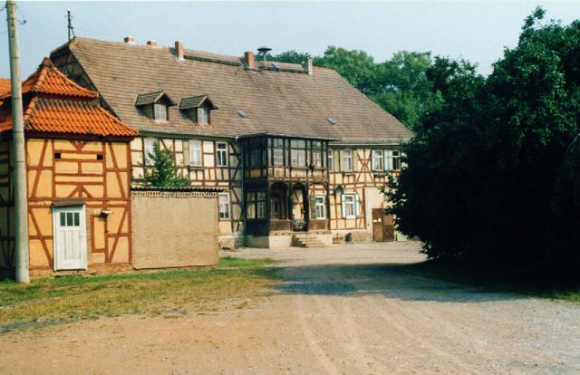
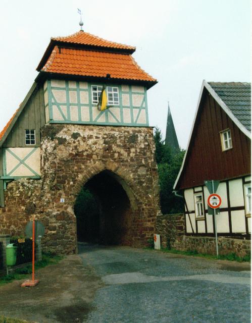
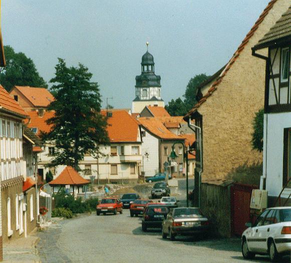
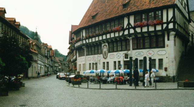 City Hall at Stolberg |
The path is somewhat adventurous and I do hard to find the small bridge and traverse across the Wipper. Eventually I reach the plateau with the nice village Heyn. Thereafter I have planned a detour via the town Stolberg, which is awarded by the title "European Heritage". The next 6 km I fly down without pedalling and without braking. I come to hold in front of the townhall, the right place to consume the third of my cheese sandwiches. The townhall has several floors, but it is said, that there are no stairs inside. To get from one floor to another one has to use the outer stairs at the slope up to the castle. The main attraction of this town are the numorous well restaurated half timbered houses. A visit is always enjoyable.
Later in the village Buchholz I pass a big sinkhole. Another signpost with informations about the geological underground. A special company is assigned to renaturation activieties, and this Bureau is Ingenieurbüro R. Völker, Uftrungen. This is our special cave and carst expert responsible (with his wife Christel) for the excellent documentation of the Karstwanderweg, which we have met at some places.
Back at my car I have made 140 km in 11 hours. I think I have enough training now to start the bike tour along the Romantic Road next week.