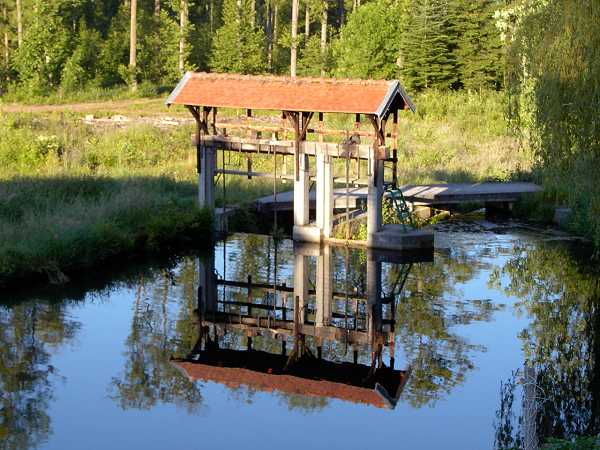
Abreschviller 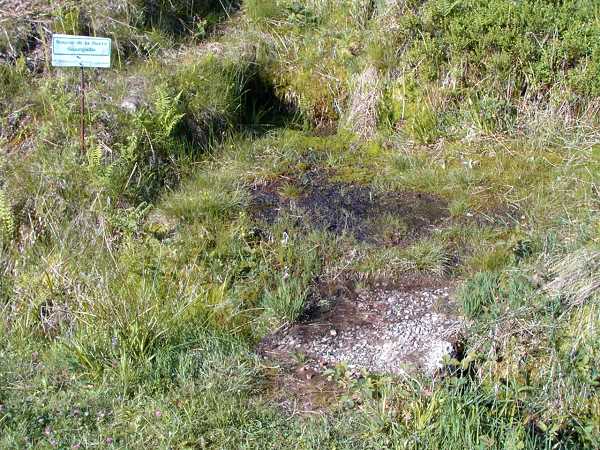
Saarquelle 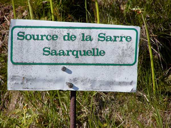
|
|
Abreschviller
Saarquelle
|
The downhill on the other side of the Col is fine for there is few traffic and the lanes are wide. My limit is 60 km/h. The race riders are faster, I know, but they have no luggage on their bikes. We come down to Schirmeck (380 m). Now there is only the main road and we have our trouble with the roaring vans. After some time I flee into the backyard of a church or a Kindergarten or both and now study the map thoroughly. And I really have overseen the small Col de Fouchy leading towards Ste Marie aux Mines, where the famous Route des Cretes starts. This route was built after the WWI (World War One) by the French military to defend the Vosges mountains agaist the barbarians from the east. It rises to 1000 m height and then stays at this height for about 60 km. At weekends with fine weather it is the eldorado of motor cyclists. The weather is fine as well but we have no weekend.
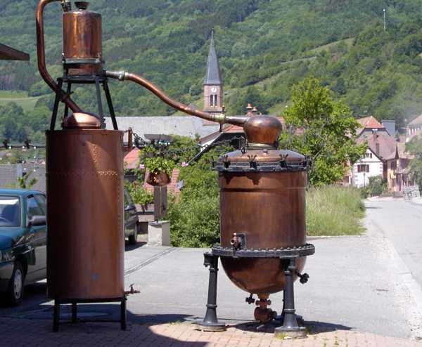
Destille-Apparat 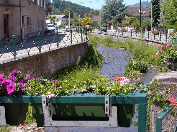
Villè 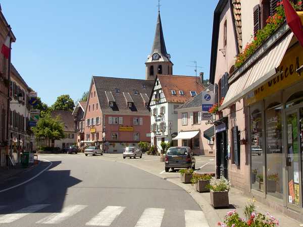
|
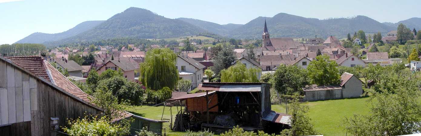
Villé |
At the Col de Fouchy we have
to push the bike for a while and so sometimes stop and enjoy the views.
Once a snake crosses the street in front of me. It is longer than one
meter but it disappears in the grass before I can recognize her
characteristics. Be lucky that just now there was no automobile or
motor-bike coming along. So eventually we reach the summit and then
descend into the Val d' Argent.
At Ste Marie aux Mines I try to find a hotel. There is one but
everything is deserted - may be it is too early in the afternoon. There
is another hotel up the valley, a well known start point for the Route
des Cretes. Let us sweat for another while - we have 27 deg. now. At
last we
come to the last bend and there it is: Les Bagenelles, "Tour-Riders are
Welcome". I am only a pedal-biker but the money that I pay (45 €) is
the same. Now this is a wonderful place surrounded by the mountains.
The only noise are the sounds of the cow-bells and this is music that I
will hear during the most parts of the further tour.
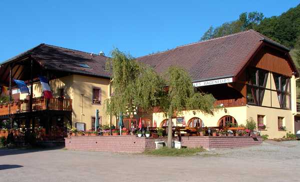
Hotel Les Bagenelles 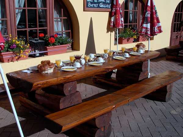
|
After so much sweat today I make a laundry and hang the clothes on a
sunny fence outside. There comes a snoopy donkey along and sniffs at my
bike shirt (fire red and purchased on my Tour de France in 1995). So I
take my clothes and bring them to another place. May be the
donkey would
like to wear such a proper bike-shirt himself? The donkey appearantly
has a female companion because they often like to spoon with each
other. Moreover there are geese and aside a lucky pig in it's muddy
pigsty.
At dinner I have porkmedaillons and housemade "Spätzle" (something
like noodles). During the late evening finally there are more than 10
motor bikes in the stable and my poor little bike is nearly crushed.
6. Day, Th 8.6. Ste. Marie aux Mines
- Altkirch, 135 km
I have finished my breakfast when the sleepy motor cyclists blink into
the sunny morning. They will have their breakfast outside and let us
hope that their butter will not melt. So we have "Kaiserwetter" and
tailwind today - a highlight of the tour ahead!
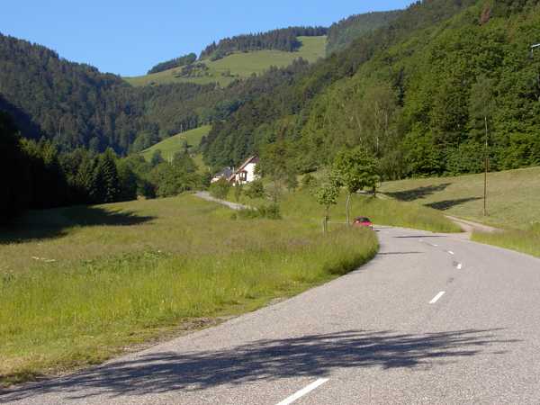
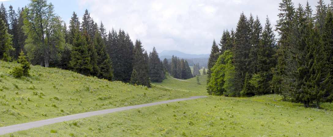
The climb from below... 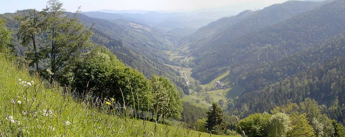
...and from above |
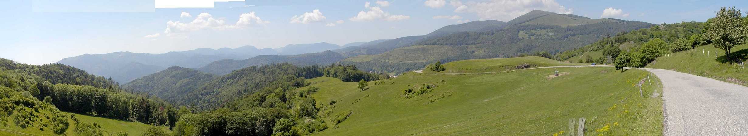
At first we have to climb 600 m to reach the legendary Route des Cretes. This takes about 2 hours until the Col des Bagenelles, 911 m. There we have a magnificent view above the blue ridges of the Vosges. We will ride the next 60 km at the height of about 1200 m. Of course much up and down but never for a longer distance. The key-points are named Col de la Schlucht, 1131m, or The Markstein, 1192 m. As well these places are the most nasty stations because there are wide parking places with busses and hordes of bus-tourists who hasten to the next toilets or restaurants or both.

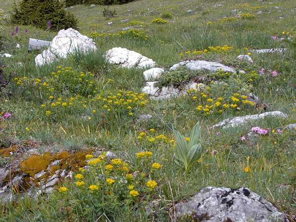
|
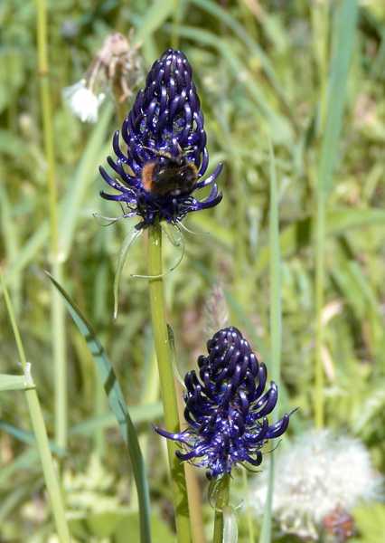
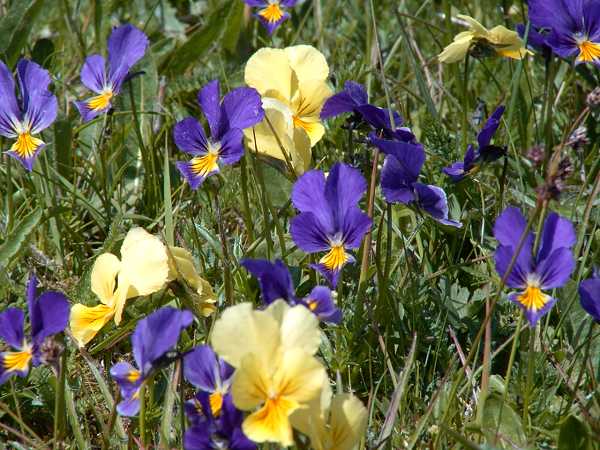
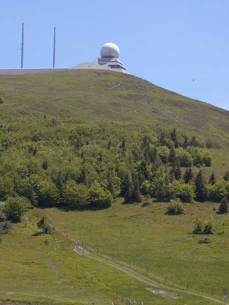
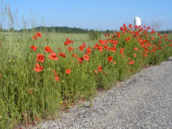
From a bicycle you will see, smell and hear more: the wild pansies at the side of the road, the tree tops with moss, the sound of the birds and cows and crickets. The direction of the views is mainly west and the cause for this is the strategic fact, that the route should be hidden from the east. At last we have to climb up to the Grand Ballon, 1324 m, and this is the highest point of the day. Up there are parking places and much touristic activities as well.
|
We run down unwillingly because the Vosges-tour soon will be over. Above Uffholz, where the road ends, we pass the Hartmannsvillerkopf and a memorial. During four years of WW1 this hill of strategic importance was the place of bloody battles and about 60.000 soldiers of France and the same number of Germans were killed. Unbelievable, but see the war cemetery at Cernay or other places with the innumerable rows of grave-crosses.
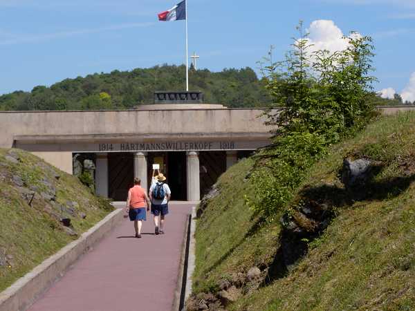
Gedenkstätte Hartmannswillerkopf 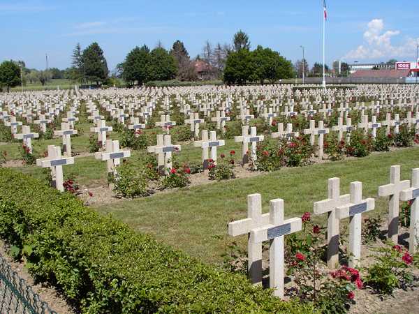
Soldatenfriedhof Cernay |
At Cernay we have reached the plane of the Rhine and the temperature is like in an oven: we have about 34 deg. The other problem is to find out of Cernay. I pass a dusty gravel factory or so and then end at the driveway of a busy motorway. For I won't go to Paris nor to Marseille I must turn and ride back the dusty road. Eventually I find some side roads to approach the town of Basel. But today I only reach the town of Altkirch. Above the mountains of the Vosges meanwhile there are strange towers of clouds, it looks like columns of steam coming from a volcano or bush-fires. May be we have a thunderstorm tonight?
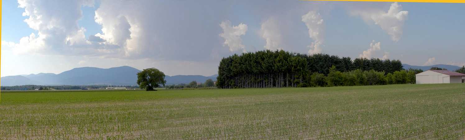
Clouds above the Vosges |
So I look for a
hotel at Altkirch. The only one is closed. I ask a baker in front of
his shop. "A hotel would be nice, but there are no employees" he says.
So some km ahead there finally is a hotel at Wittersdorf. The chief leads me to
a poor room, but as usual I am very happy to have any home. There is
only a remote skylight window with a noisy aggregate behind it. But
then I detect a swimming-pool down in the garden and soon I am in there
and enjoy the refreshment after a hard day.
The dinner comes out of the bags, the restaurant is too expensive. I am
very happy as the aggregate falls in silence at about 10 pm. But at the
next morning I will be annoyed that they charge 50.- € for this
despicable hole of a room. And the breakfast is not so good as well...
(The French serve a Petit dejeuner
and it seems the Petit is the
main thing of it...).
7. Day, We 9.6. Altkirch - Basel - St.
Ursannes, 105 km
I must go to Basel to get the first brochure of the "Veloland Schweiz".
During the last few years they have managed to generate a grid of 9
long-way cycle-tours, to sign them, to document them by fine brochures
and to sponser them. Of course those trails are more sportive than in
Denmark or Holland, which are fine countries for cyclists as well. And
Germany of course with fine river-routes. People have recognised, that
the cycle-tourism may be an important fact in local economy. And if I
look into my wallet one can see, that is not so cheap to go this way.
May be it is a question of age: you like it more comfortable at some
time. The cheaper solutions are a tent and camp-grounds, youth hostels,
private pensions or cites and self made food. May be all the money you
throw out will be kept off of an medical institute, which you are
forced to consult caused by a lack of motion or another disease.
|
At Basel begin resp. end three routes: Jura-Route(7),
Rhine-Route(2) and North-South-Route(3). I want to ride the
Jura-Route. So I only have to buy the guide for it. After 30 km
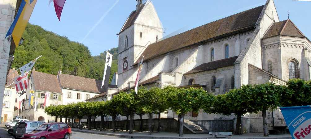
this morning I arrive at Basel, just at the
Spalentor, and the last
time I was here is more than 40 years ago. Aside this towngate is
a book shop. The owner has never heard of any "Veloland Schweiz". May
be he has learnt something by my demand. I should go to the
middle-bridge, there would be the information center. So I do, but
cannot find the information. But a good bookstore to finally purchase
the guide to veloroute 7. And that I do not behave like a philistine
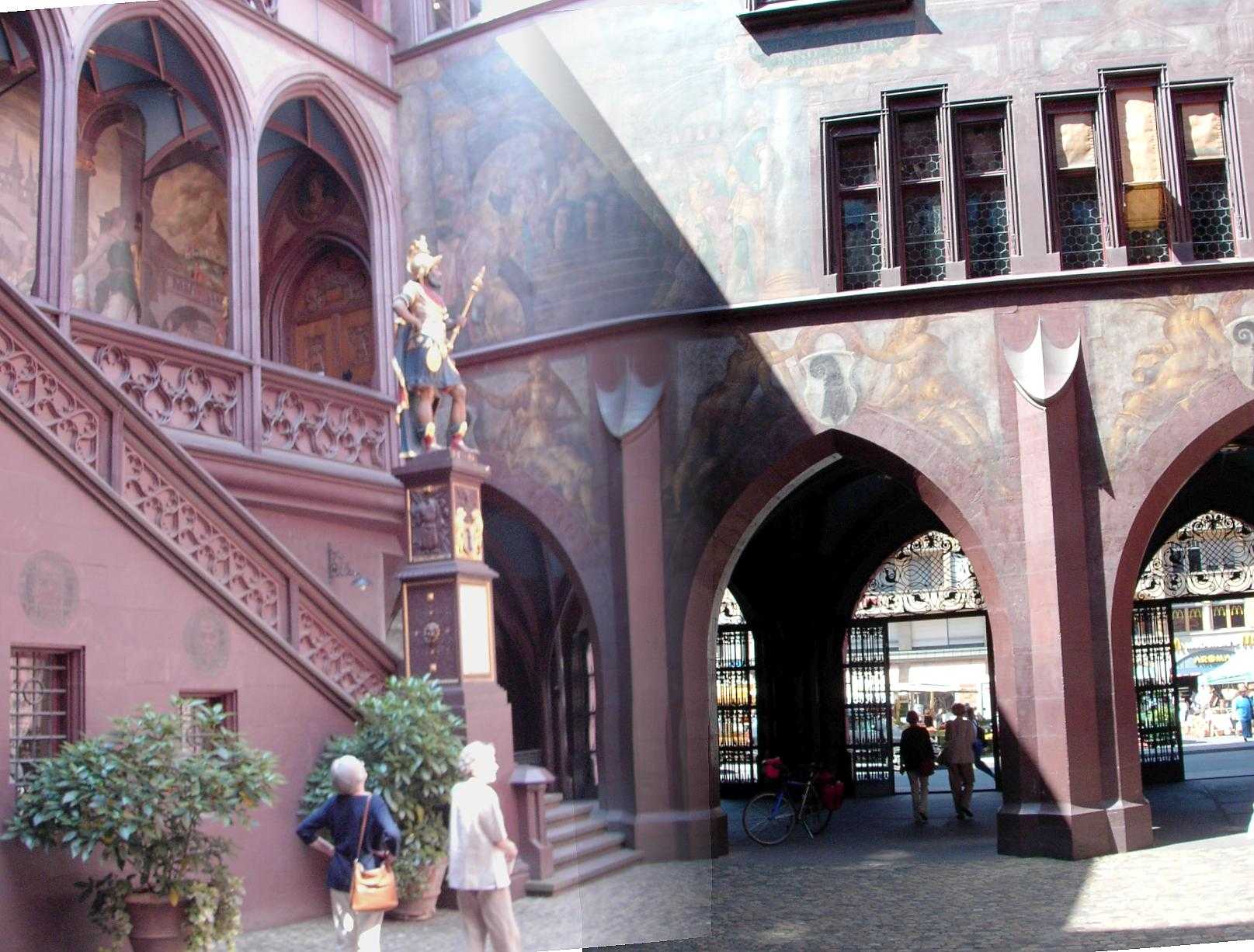
(Kulturbanause) I find may way to the market place and the townhall
with it's inner yard and the
wall paintings.
But then we must continue.
The veloroute is signed from the town center at the Rhinebridges. They
have managed to find a way nearly traffic-free out of the town,
sometimes along a rail-track. But then there seems to be the end of school
somewhere and I find myself amidst of a cycling group of kids. It is
just a steep uphill and I won't give up. May be I missed a fork by this
challenge and finally are in unknown areas (Biel and Benken). Turning towards the
mountains of the Jura I soon find the signs of the route again. So
I have a rest on a meadow near Mariastein.
This should be a place of pilgrimage but it is up on a hill. So I stay
to my meadow, and thereafter have to climb anyway. We reach the nice
village Metzelern, where cheering kids have a bath in the
fountain-basin of the village ("Eaux non potable" - no drinking water).
I would like to do the same. To get something drinkable I enter a pub
and go to the toilet. I get some water, but it is difficult, to
mnipulate the 2.5 L bottle between the wash-basin and the water tap.
Now a serious uphill follows up to 747 m, mostly in the wood and
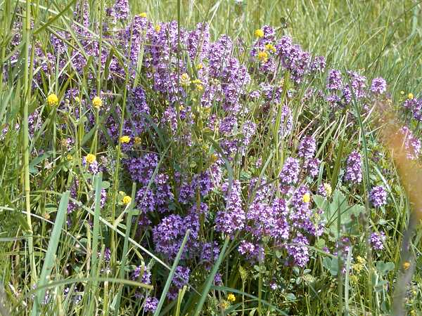
shadow. Up there we follow a nice path on a ridge and enjoy the first
views on the blooming meadows of the Jura. There are not the
flowers alone but also a noisy concert by the crickets (Grillen).
At a nice rest-place another cycling couple enjoys the landscape.
Moreover there are joggers, walkers and hikers. Eventually I practise
the Suisse greeting and this is "Gruetzi!". But a poor "Grützi"
comes out of my rough throat and I prefer to say Salut or Servus. The
other greeting phrases like "Pfüat di mitanand" or "Auf
Wiederluage" are too difficult anyhow.
At the end of the path on the ridge we fly down on the tarmac of a
small trail among the meadows and cows. Suddenly there are two small,
nearly invisible sticks across the path. The brakes yell and I bump
against the sticks. But those are fixed by an elastic attachment and
swing aside. This arrangement seems to be for the cows which won't like
to cross these barriers. Another barrier are the well known cattle
grids, which are no problem for rims and spokes. We then reach the
valley of Leimen and Lützel. There is another
historic trail swinging binational between Switzerland and France
without any border controls.
As I once have a rest aside the road the young couple from above comes
up. These are Stephanie and Raphael on a short holiday for the
Jura-route. We discuss where we could stay overnight. There is a
very picturesque town named St. Ursannes 25 km ahead but a steep uphill
of 789 m before. We are all tired a bit and do not know if we could do
it today. Other places for an accommodation are rare in this area. In
the next village Courgenay I find a supermarket and so can buy enough
to be independent for the coming fate. Another cyclist comes along whom
I had seen before. He is really on pilgramage to Santiago. He
argues if he should continue from France per pedes. His daily budget
are 25.- € , so he lives with a tent and a stove and other camping
equipment. He looks to my speedometer and says "If you have 90 km
already we will not meet again". He is right.
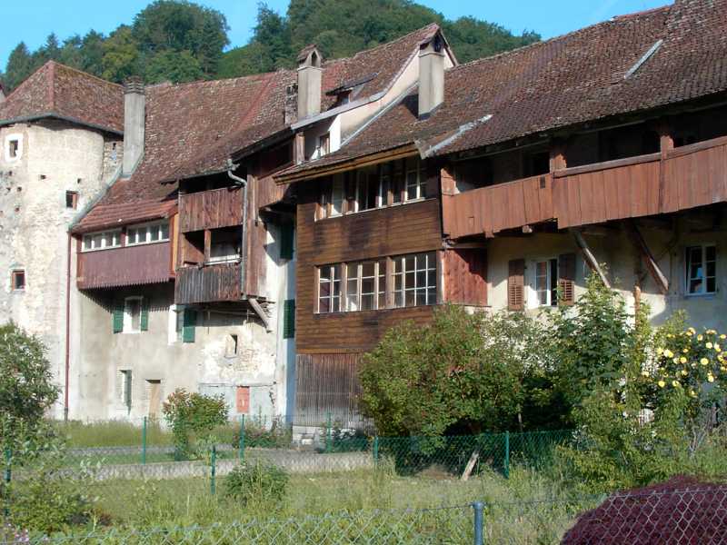
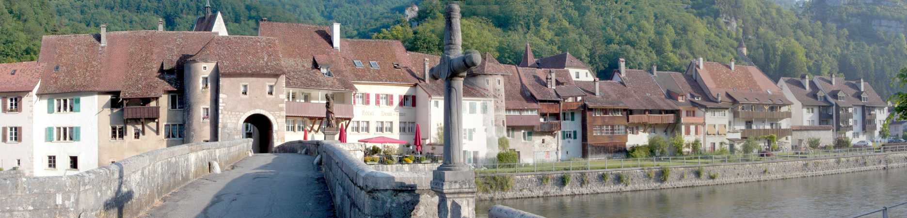
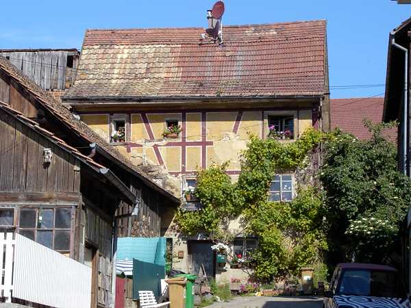
 St. Ursanne St. Ursanne
|
I really start to overcome the uphill. It is crual. May be 20 %
gradient. You must bend the upper part of the body down to the handle
bar to push the bike. And you (may be not you - but I) have to stop
after a while and breath out. After a long steep ramp I reach the last
curve before the summit and fall into the grass. Now a vivid mountain
biker comes from below, twisting the pedals in a much lower
transmission than available at my bike. I clap my hands to give
applause. So I have recovered and then fly down to the valley of the
river Doubs. The brakes and crickets yell in turn. Everything flies
along as you must concentrate to the downhill path. In no time (from
the summit) we now reach St. Ursannes, the favourite destination for
today. On the central place I meet Stephanie and Raphael who just
admire the medieval surrounding. They have arrived minutes before - so
I am proud not to be so slow. My other eye has detected some hotels
meanwhile. S. and R. will go to the campsite and purchase a travel
trailer for the night. I go to the Demi
Lune (55.- CHFR).
A laundry of the sweated shirt and shorts again - you know my drying
practise? Roll the clothes into a bath towel and jump
around on it. Then everything is nearly dry.Thereafter you may sit on
the terrace of the Demi Lune above the river Doubs and have your
dinner. We choose a cordon bleue with pommes and two big beers. Let us
state once again: life is wonderful especially at this place! (On
the further tour there was no place approximately as picturesque
as this one)
The river Doubs is a very mysterious one. There are deep gorges and
canyons and so it is mostly unreachable. At some places the waters run
underneath and come out at another place again. The rush of the waters
accompanies my dreams.
8. Day, Th 10.6. St. Ursannes - Le
Ponts de Martel, 85 km
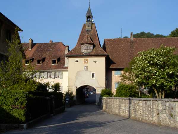
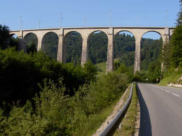
In the sunny morning we shoot some fotos of this romantic town. Today we have
another uphill up to 1000m, that is 500 m higher. We pass the viaduct
of the railway, see it from below, but some time later we see it from
above. I then meet a woman with a shepherd dog. "A pretty stretch
ahead" she says. "But the views get better all the time" I say and this
is true.
|
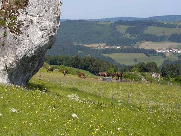
Finally the route leads up above at 1000 m height all the time and is nearly traffic free. Meadows, flowers, lonely estates, cricket noise, red kites, grouped trees - all like a park landscape. As I just pack in my camera S. and R. come along. They want to visit a cheese factory at the village with the pretty name Saignelègier. But they will not succeed because we have a celebration day today, Feast of Corpus Christi or so. For the last time we meet at a lake named Etang de la Gruère. From there they roll on and I did not see them again. But I gave them my card, may be they send a mail at some time.
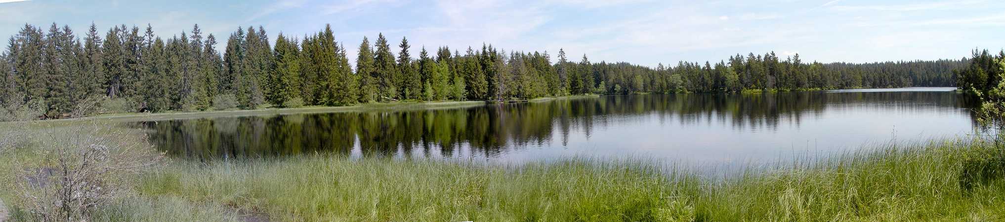
Etang de la Gruère |
So let us visit the lake, shoot a panorama an then flee away from a
noisy group of kids and lads. The next higher point of the route is
then Mont Soleil, 1200 m. At
a rural restaurant I want to refill my bottle again and have the same
problems as before. So I rush behind the counter and quickly fill the
bottle with water (not beer) while the woman of the restaurant is busy
with her mobile. As the full bearded chief comes up I and my full bottle
just disappear around the corner.
At the slopes of the Mont Soleil corresponding
to the name they have arranged a solar-parc. One can visit this place
but in the moment we just have no sun. Some time later I even have to
hide under a barn's roof to keep dry from a sudden but short rainfall.
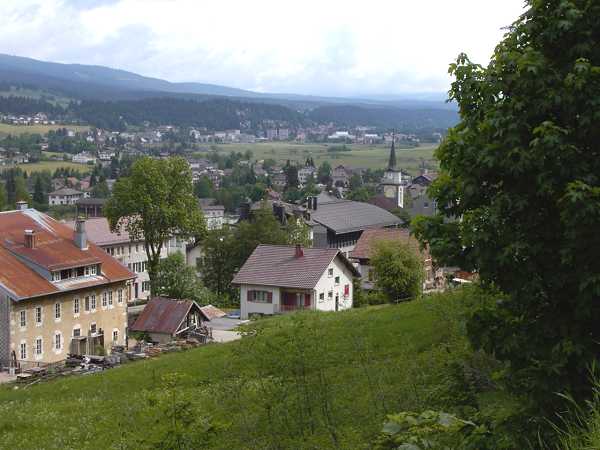
We then run down to the town La
Chaux de Fonds. "a revolutionary style of town planning in 1000
m height" is to be read. May be something like the German "Bauhaus"?
Even the famous architect Le Corbusier was acting hereabout but left
the town with anger. Today they are proud of the famous name. I only
touch the town and head for the last 20 km until the village Les Ponts de Martel. In this valley
(Vallée des Ponts) there are high moor areas and near the
village there is a karstphenomenon where the waters from above
disappear in the ground. But at first I look for a hotel but there is
no one, the people sit in the restaurants and drink.
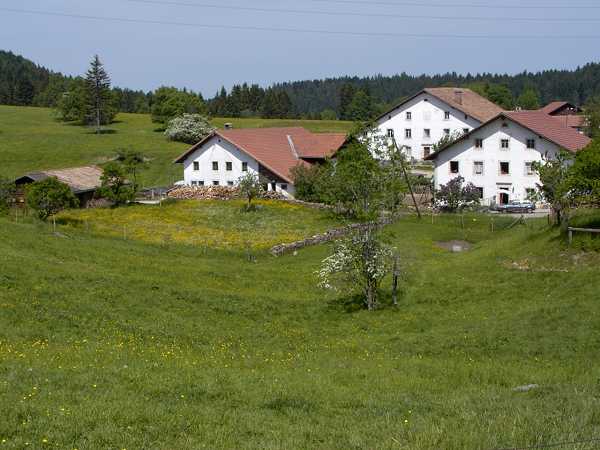
Some km ahead I finally arrive at the Restaurant
de Poneys. Though I made not so many km for today it was another
hard day. I get a complete storage under the roof here and I am the
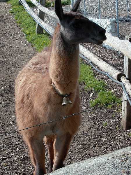
only guest. The view outside shows a meadow with cows and a
curious Llama. Let us hope it will not spit. At dinner I get Schinken-Rösti, this is bacon
and rasped potatoes or so. I pay the bill and declare that I will
start before breakfast tomorrow. "You don't want to eat?" they ask. I
insist to say "No" and so they may argue what a freaky madman was
coming in and at once is going out again? So do I!
9. Day, Fr 11.6. Le Ponts de Martel -
Le Pont, 83 km
At 6:30 am the freaky madman tiptoes down the backstage and starts into
a misty morning, awaiting another day with "Kaiserwetter" and tail
winds. He is wrong today and better should have enjoyed a solid
breakfast. Now it is grey and cold and after some up and down we reach
the valley of the Traveuse
and have breakfast on a bench (bread and cheese). A man comes up with
his dog but both immediately retreat vis a vis this freaky guy on the
bench.
We ride down the Val de Travers
with some industry. We pass towns as Couvet
or Fleurier. Another 400 m
heigh climb is waiting and when this is accomplished the rain starts.
The next pass ist the Col de L'
Aguillon, 1320 m. A rest before under the roof of a deserted
factory building. I see another cyclist coming along under his
raincoat. I meet him some time later when he packs in the
raincoat. This is Markus, a Suisse guy who rides around following the
side roads of the Michelin road maps. "Let's go together for a while"
he says. "OK, but I am not so fast" I say. "I will conform to it" he
says. So we ride together and the uphill is moderate.
I get to know some stories. His accommodations are huts or meadows or
under trees. Only yesterday the youth hostel at St. Croix, 30 CHF, this
is expensive. His brother once was a member of the famous Suisse
velo-regiment. Now he has a bad knee and cannot cycle since then. I
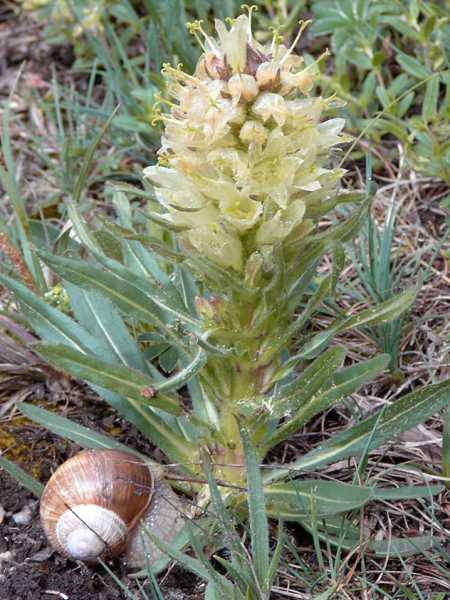
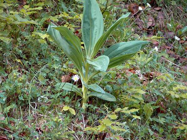
show him the flowers aside named "Trollblumen". He has never heard of
them. I ask for another plant which is to be seen everywhere, for the
cows apparently do not like them. He says: "May be this is the
shitflower
because the seed comes out of the cows and their stomache".
I believe that this is not the solution to the secret of this plant
(I believe it is the highly toxic Weißer Germer, Veratrum Album, and
in earlier times this
was used as a poison for murders - so to read in the internet).
Meanwhile I am out of breath and say that I need a rest and will
continue somewhat slower. So we part, he gets the card and may be he
reads about himself at this place one day. The rest of the pass is easy
to climb and on the summit you may breathe out: there they are, the
Alps. A blue jagged silhouette! It is too hazy for a photo, but be
patient, you will get your photos!
We fly down in zigzag and full braking. But the rims are not so hot that
they would burn off the tyres. At Baulmes they have school-end and I
must walk through the masses of wild pupils. The further route is not
so clear, so I pass a lonesome horse three times (1. forward - am I
wrong? - 2. back - no I was right - 3. forward). But the path is bumpy
and not so good. Back on the road the rain and wind resp. storm comes
from ahead. At first I cower behind a barn, then in the hut of a former
wash basin
with a fountain. It rains heavily. After half an hour or so the rain
runs out and I can go on, the wind is not so strong finally. We come to
the town Vallorbe and then have to overcome the last pass M. d. Oxeires, 1000 m, for today.
Unfortunately there is only the main road available because the smaller
path on the other side of the valley is steep and rocky (so it is said
in the guide). Up above on the summit there is the Jura-Parc. Some
birds crie like pelicans but this would not be their natural site. You
can observe bear, wolf, bison and other animals. So do some families
with buggies and children who strive towards the entrance. Some days
later this place will be the arrival of a Tour de Suisse stage. This year
this tour was won by Jan Ulrich,
but may be only because I was always in front of him.
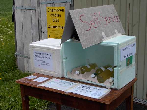
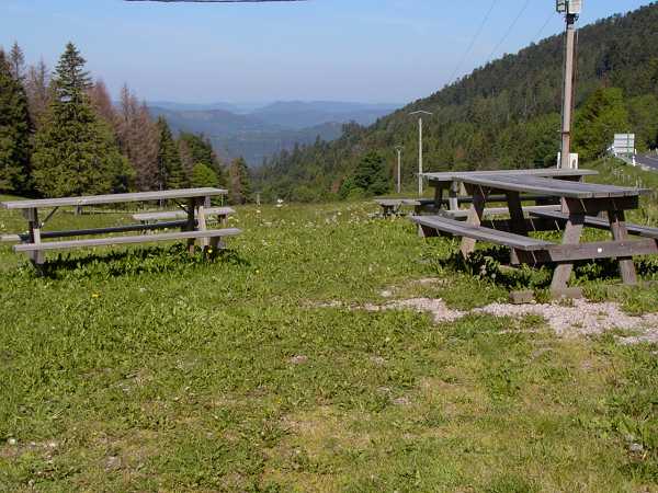
Selbstbedienung 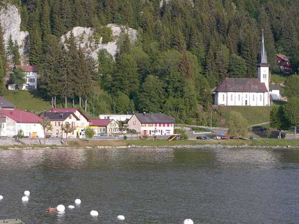
Le Pont |
The downhill is short to the village Le Pont, located between a smaller and another longish lake, the Lac de Joux. Though I started early I have not made much distance today. But the weather is too bad so I finish at Hotel de la Truite. Some time later it rains again so I was right.
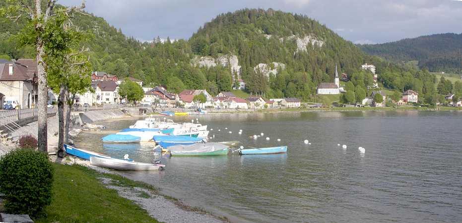
Le Pont |
10. Day, Sa 12.6.
Le Pont - Cully, 113 km
There was a steady rush by the rain during the night but the morning
looks better. Today it will be the last stage in the Suisse Jura.
Along the shores of the Lac de Joux, where the anglers set up their
environment with rubber pants and so on.
Le Brassus 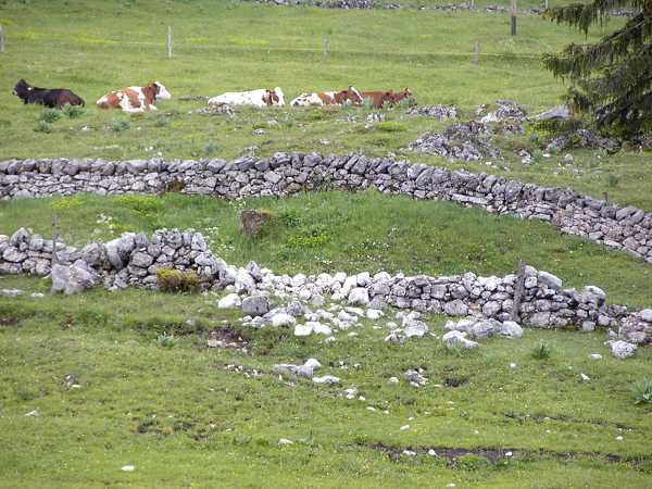
Steinmauern 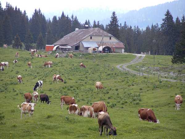
Bauernhof hoch oben |
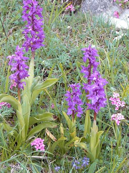
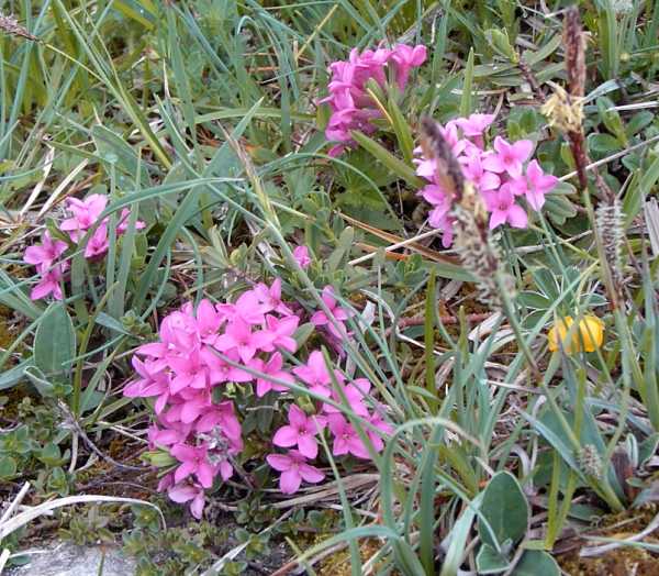
From Le Brassus, 1021 m, the last climb leads to the Col de Marchairuz, 1339 m, and this is the highest point of the Jura-tour. But the climb is very amusing: the wide views to the Val de Joux (joux=wood), pasture land and meadows crossed by stonewall hundreds of years old, flowers aside the road. Once I sit in a natural stonegarden to take a photo of some orchids and primroses. I would like to sit still there.
|
So we are soon at the highest point where we have to go right and know: no more uphill at all. This is beautiful high valley with a narrow road. Suddenly some oldtimer cabriolets come along. They are as happy as I and we wave to each other laughing. Now let us concentrate to the last and long downhill. There are dangerous gutters across the street so a higher speed is not possible. It is always a sad thing to change the energy, that was saved by sweat into the heat of the rims.
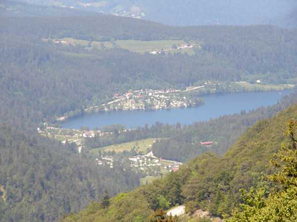
Hochtal 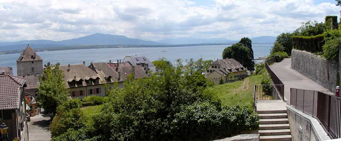
Nyon und Genfer See |
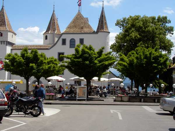
Let us stop at Bassins and throw a view to the Lac Leman and the
panorama of the Alps. The town of Nyon is the final point. We have noon
and I will continue. I want to buy the brochure Rhone-Route, Tour 1,
which leads up to the Wallis and the sources of the Rhone. The tourist
bureau is closed. The bookshoppers as well as the kiosk sellers are
completely innocent concerning Veloland Suisse. I only can purchase a
road map of the south-west Suisse so that I am able to recognise the
current location. This was 10 km detour because I could have turned to
the route 1 earlier.
From Nyon towards Lausanne I first use the main road. This is no fun.
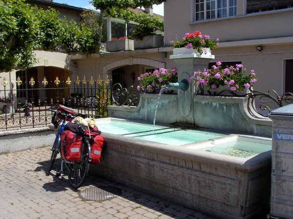
At the fork to Gland I turn left and soon hit the signs of the
Rhone-Route. Now we ride traffic free among wooden houses and flowered
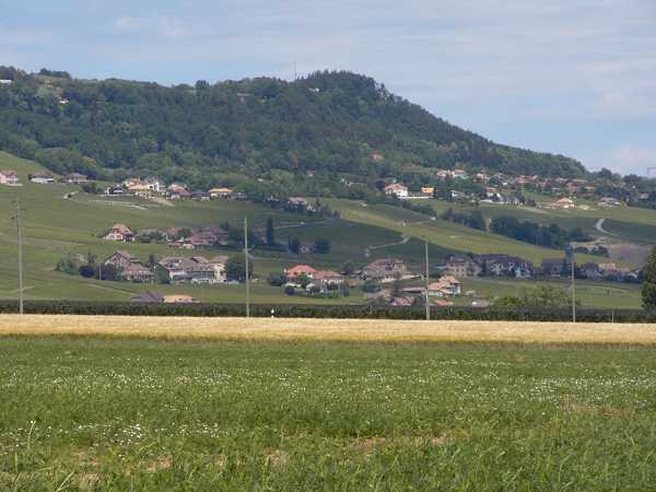
village fountains. This is another thing, we pass the nice vineyards at
the southern slopes of the Jura above the Lac Leman with a
wonderful sunshine.
|
Once I have a rest at the lake. There are two great
crested grebes (Haubentaucher) mating. Suddenly they forget their love
and hurry crying towards a certain point of the water surface. At this
point a bended backside of an animal is to be seen, then it disappears,
then it comes up again. No fish, larger than a rat. So I can only
argue: a beaver or an otter or a Suisse Nessie. Let us believe in the
last assumption.
A larger town Morges follows and a bookshop has the Rhone-brochure, but
in French only. I visit the supermarket to be autarcic for the evening.
This area is not the cheapest - as everyone knows. We come to Lausanne
and prefer to stay to the shore of the lake. Eventually we find a park
with remains of the Roman origin Lousonna.
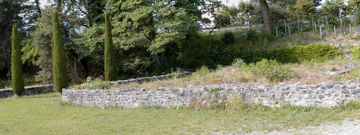
Reste des römischen Lousonna |
The modern Lausanne is roaring to the left and I succeed to avoid it
nearly completely. Back in the vineyards we once find a twisted
concrete path half up the slopes and this is beautiful (near Lutry?).
Behind the village Cully there is a Comfort Hotel with the flag of the
Suiss Velo-Organisation. So we stay here for the night. I choose a room
on the backside where unfortunately the Lac Leman is not to be seen
but fortunately the roaring traffic of the road is not to be heard. I
spend the evening with laundry and dinner from the bags.