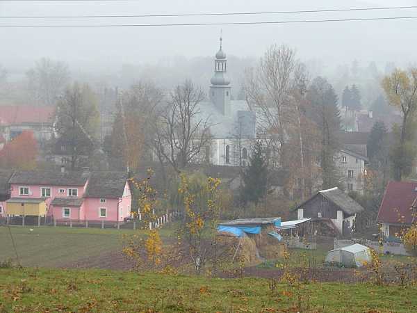
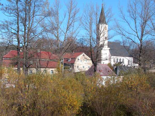
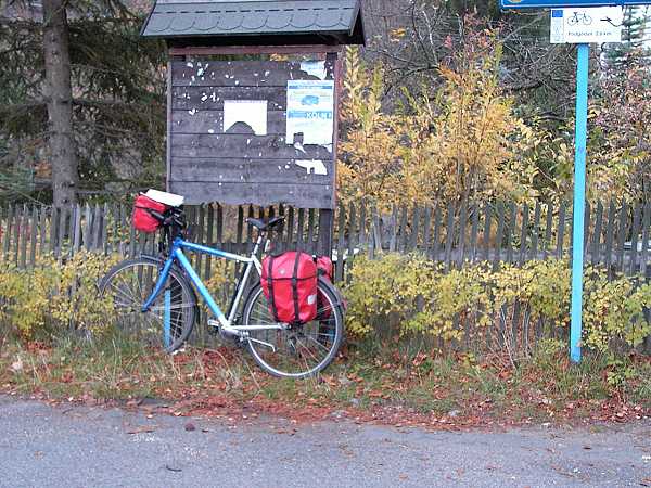
Javornik 
Border to Poland 
Goscice |
|
Javornik
Border to Poland
Goscice |
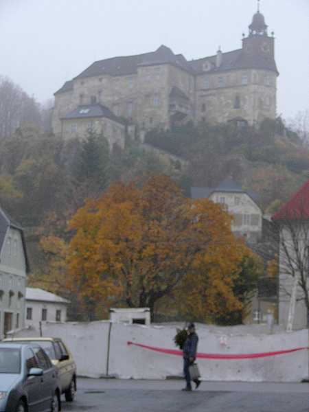
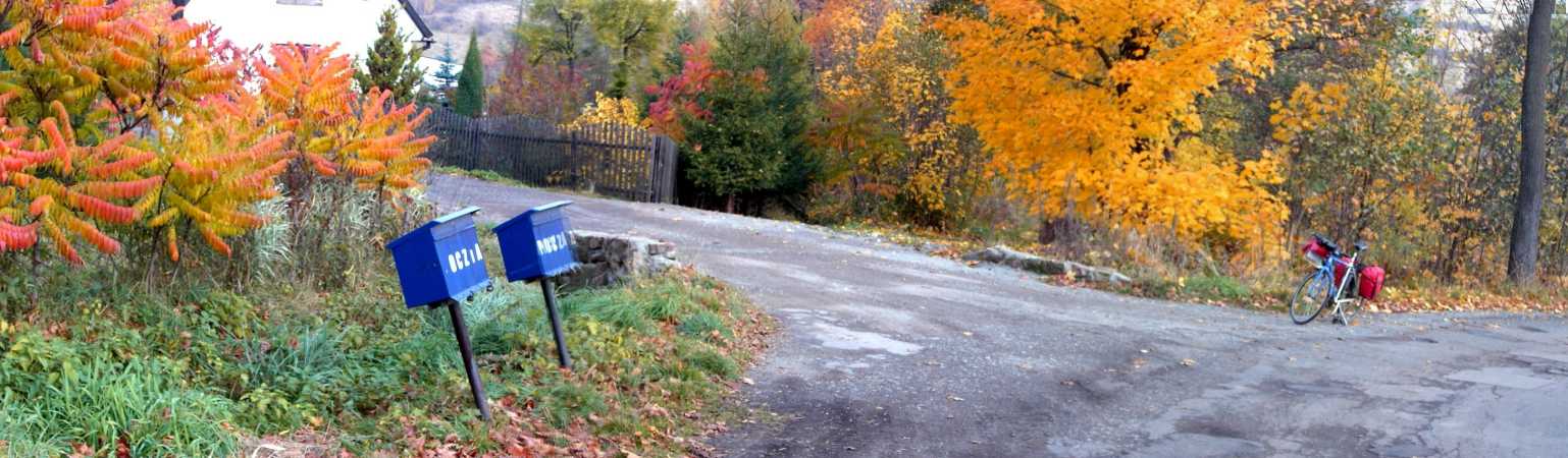
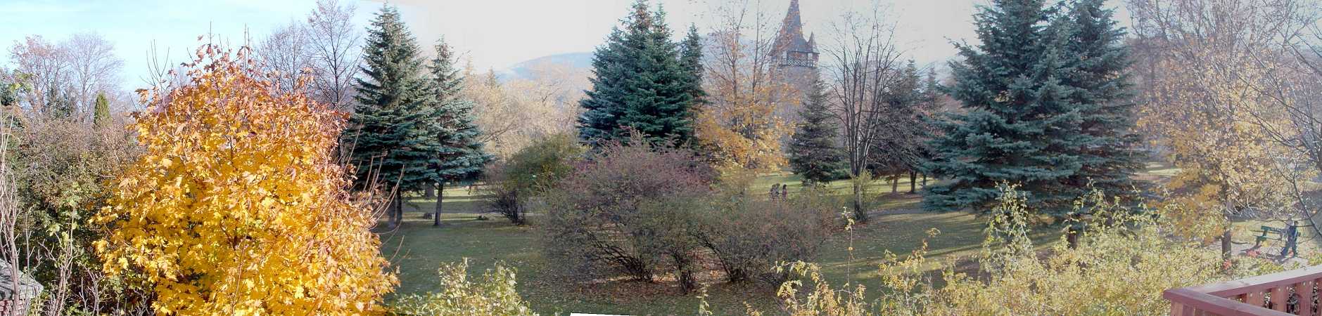
We then reach the border and now are at
Poland. The next town would be Paczkow (Patschkau). But I turn left
before into a side street and see the first village which is stretched
along a runnel or river. The name is Goscice (Gostal). I am so curious
to ride this road until its end because there is the border again with
the village Bila Voda, and this is easy to translate and means
Weißwasser (White Water). There is a monastery or something like that. But we
cannot cross the green border here, there is a gate and this is closed.

Kamienica 
Weißwasser 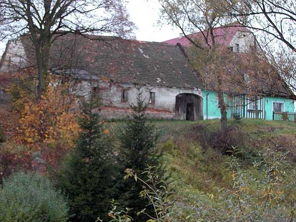
Hannsdorf |
So I end at the main road towards Glatz. This is not so enjoyable with
the big trucks and tank waggons and the spray that they produce. At the
town Zloty Stok (Reichenstein) I have another rest in a bus cabin. As I
sit and stare into the rain an old man comes along. "English,
Niemetzky?" he says. "I am from Germany" I say, and then he shakes
hands with me. Other means for communication do not work and soon he
toddles off again. From earlier experiences I was awaiting that people
usually try to get or beg anything, so this time this is not true.
Around the corner is a bank and I get 200 Zloty from the bancomat. On
the other side they are unwilling to change the rest of Czech crowns, I
don't know why. If the weather would be fine we now would have turned
to a nice road towards Ladek Zdroj
(Bad Landeck) at the Reichensteiner
Gebirge (Gory Zlote). From there there is a long valley (Biala Ladecka) to Glatz. But today
we have rain down here and up in the mountains there are the clouds and
even more rain. So once again we have to use the main street number 46
and fight for our life against the trucks and many tank waggons.
Moreover there are some hills which are extra nasty if there is no
shoulder aside the carriage way and the other vehicles overtake in a
short distance bringing clouds of spume with them. No pleasure
today - really.
Hannsdorf |
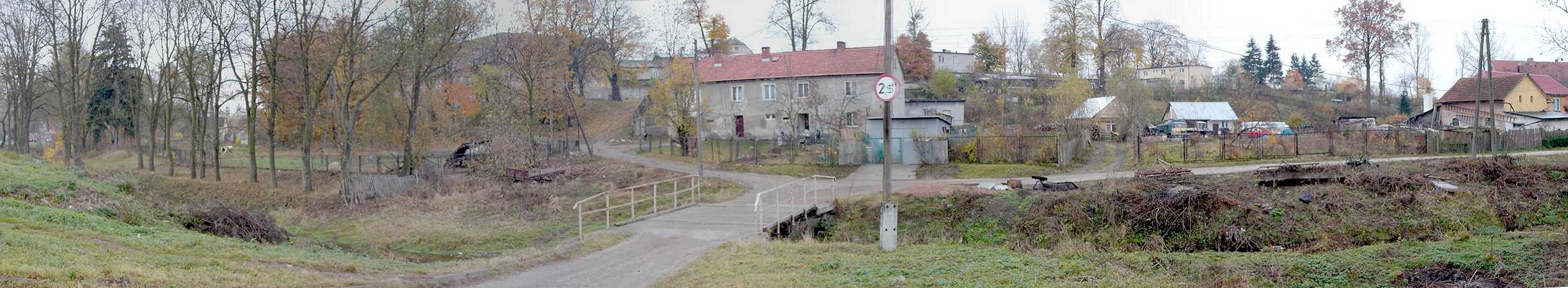
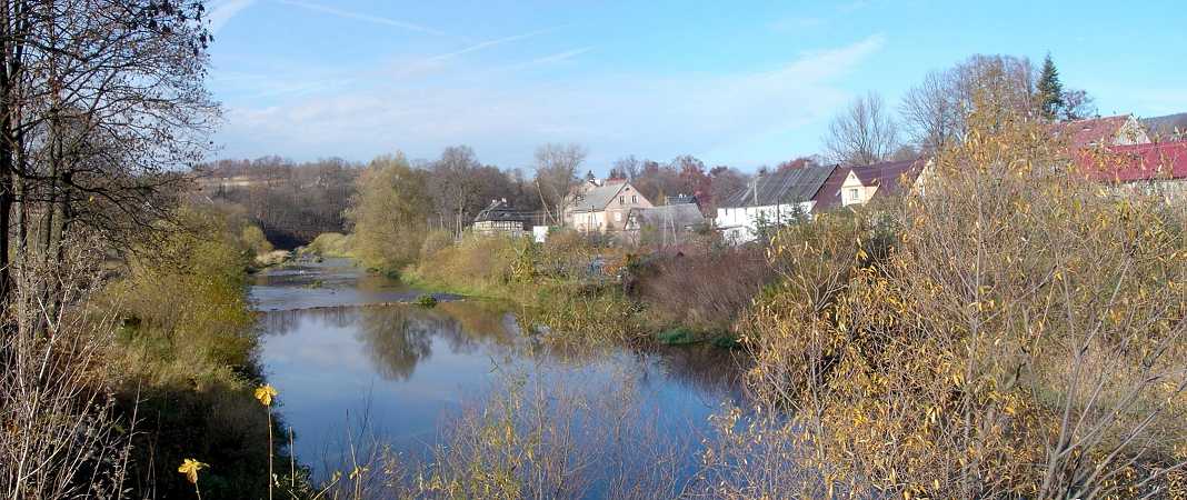
As I know to have reached the highest point there is a rest place with
a hut. I sit down and read the map. And there is really a side road
down to a valley with a long drawn village named Jaskowa (Hannsdorf).
And this is really a stroke of luck. Down there is no traffic and we
detect an original old village along a river again. These villages are
typical for this region and I think we will see more of them in the
following days. The atmosphere around here is like in former times and
at first I produce a panorama photo though the weather is not so good.
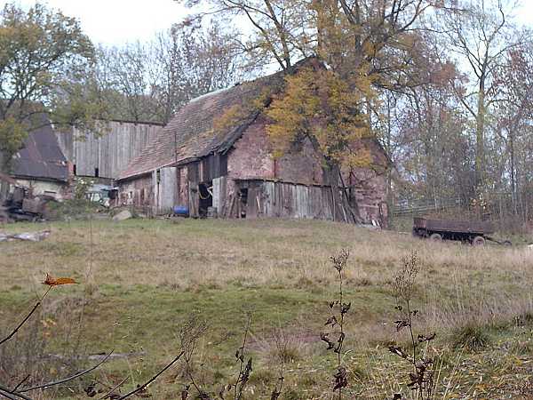
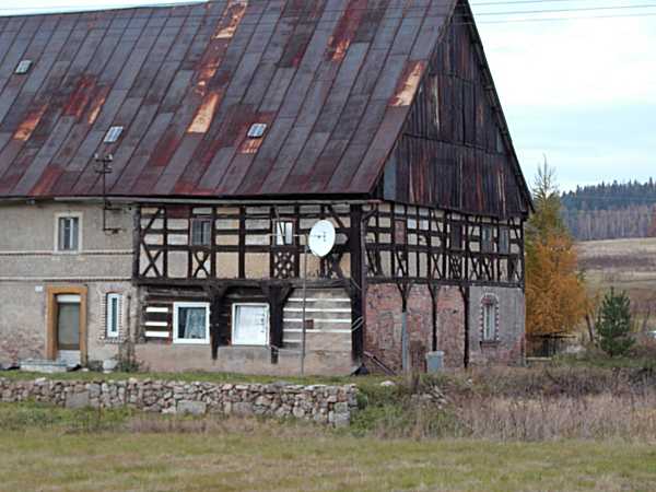
The left side of the valley is higher and there are some estates
which have seen better days - as we say.
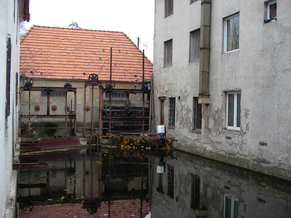
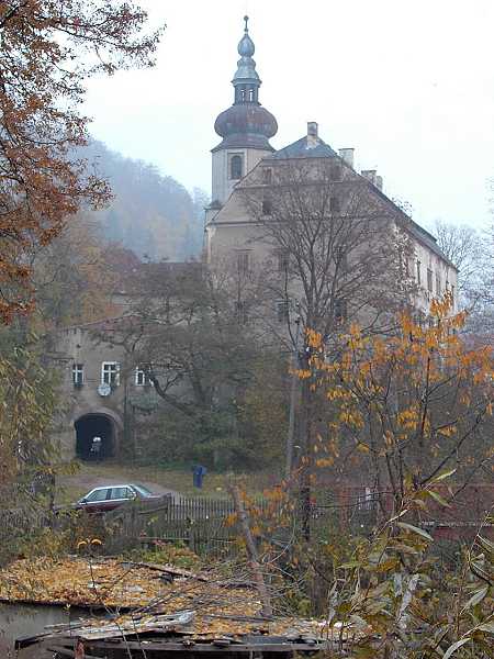
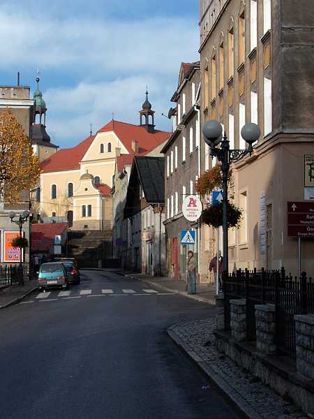
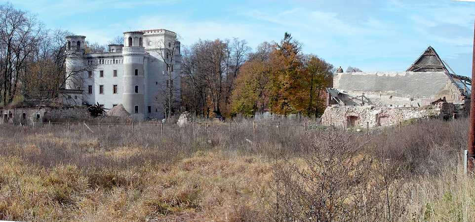
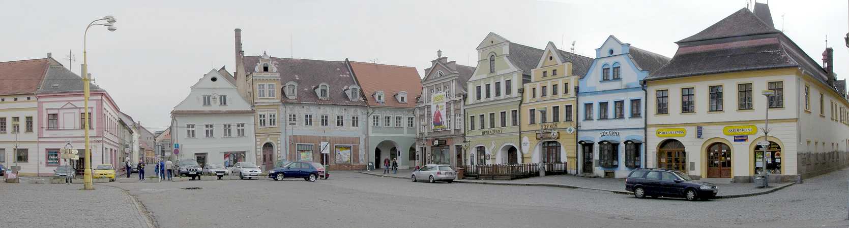
So we could enjoy the last section to Glatz. We find the center of the
town on the other side of the river Neisse over the bridge Most Gotycki. There is the market
place with the tourist information. Above all there is a mighty
fortification.We have early afternoon yet and some minutes later I
enter the Hotel Marhaba.
About the fortification we can
read:
The fortivication was built in XVII
century by the Dutch engeneer Cornelius Vallrawe The bastion,
courtyards and casemate can be visited. From the viewing platforms
there are beautiful views to the town and the southern regions of Glatz.
So there would be much more to report about this town than we can do
after a short walk around. For the top regions of the fort it is too
cold, windy and hazy. But I see a mysterious "Touristengang", this is
an underground channel from the lower town to the castell. But this is
locked by a great padlock (Vorhängeschloss).
But there is some information:
The channel was restaurated after the
World War II and opened for observation. The entrance to this gangway
is beneath the Pfarrkirche (parish church). The path is lighted and in
some niches there are figures and archeologic objects.
Neisse aside the Hotel 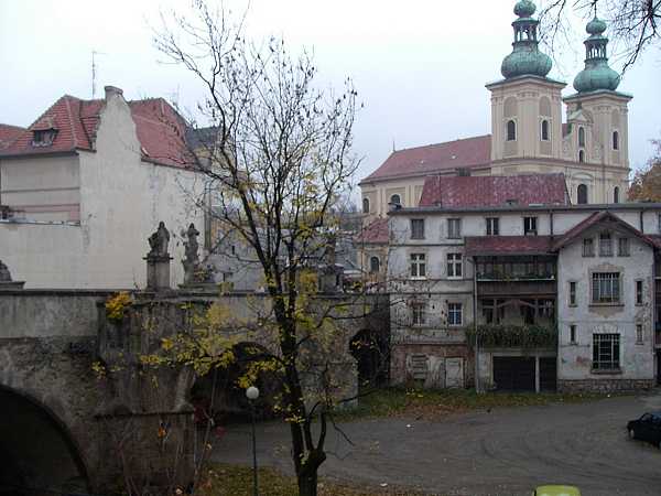
Most Gotycki 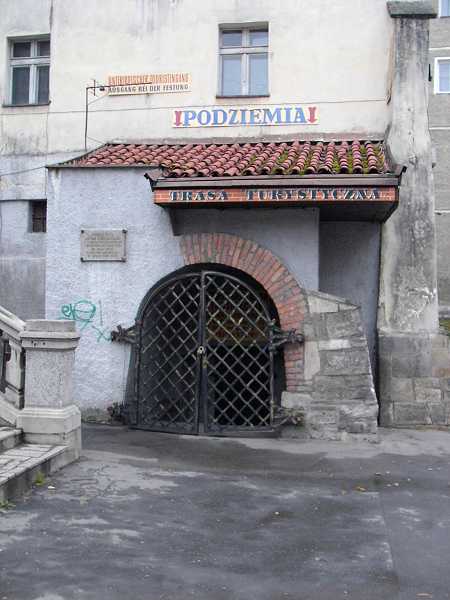
Entrance of the "Touristengang" 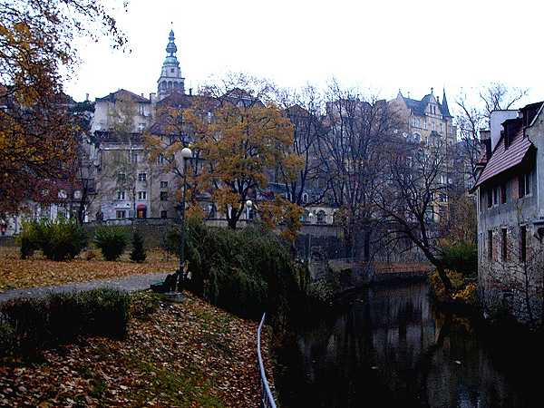
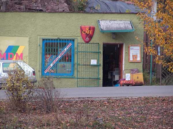
Glatz |
The pedestrian area is very busy. I worry that this soon will look like
each other at home with the same multiple shops (Schlecker, Tchibo,
C&A ...). In the evening I once again end in a pizzeria and it will
not be the last time. Today I enjoy the pizza with the giggle of shool
girls and rap-music because the pizzeria is aside of a gymnasium.
In the evening I flag the route of today in my map with blue points
that I will remember the tricky passages.
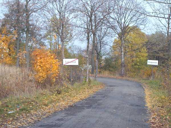
Thursday, 28.10. Waldenburg
(Walbrzych), 70 (80) km
In the morning mist there are some difficulties to find out of the
town. I don't want to go to Wroclaw, Ostrawa or Gliwice as the
signposts recommend. I must ask for the village Bierkowice (Birgwitz) and finally
find it and now - guess - start to ride along the next long drawn river
village. This is Gologlowy (Hollenau)
at the river Scinawka. Later the village is named Scinawka Dolna and this was in
German Niedersteine or Neusteine b. Niedersteine. You have
recognized that we are in the drainage area of Oder/Neisse since the
Polish border.

|
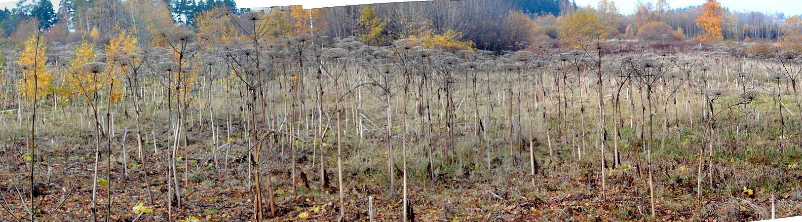
I find another side road all along the Czech border which is very
scenic with the coloured trees and forests. We have to climb up to 700
m again and then hit on the road 381 in a nice valley. I make another
detour to have the nicer roads and this is more strenuous because it is
up
and down sometimes. So I reach Waldenburg from its "backside" and that
are endless roads towards the centrum.
|
This is another story:
My hometown where I went to school is
the Westphalian town Espelkamp. During WorldWar II this region in deep
pine woods was a
production area for ammunition. After the end of the war the
allied forces immediately started to destroy this adversial
institution. For there was a totally intact infrastructure (factory
halls, houses, roads, railway, electricity, water support etc.) the
Swedish priest Birger Forell had the idea to conserve this are as a new
hometown for the masses of homecomers and displaced people from
the east. This worked and the thankful new settlers choosed the names
for roads and pubs (e.g. "Pommerscher Hof", "Sudetenland") from their
lost eastern towns and rivers. So I meditate about a "Waldenburger Hof"
- was this a pub or a place in Espelkamp? Finally I remember, this was
the address of the second flat of my mother. Must have been a blackout
in my head...
|
So it happens to me to be in Waldenburg! There is a busy traffic and I
do hard to find the centrum. There is a signpost for the tourist
information, but I cannot find the bureau. And I don't see any hotel.
On the second loop I ask a woman for the tourist bureau. She doesn't
understand, but I should follow her, her father speaks German. So
suddenly some minutes later I stand inside of the domicile of a family
in Waldenburg. And they are very kind and try to help. They phone for
the next hotel but there is no connection. So finally I am instructed
to ride to the Hotel Sudety nearby. Many thanks to you, my family in
Waldenburg.

|
The Hotel Sudety is an old leftover from the Socialism, a big block and
they do hard to offer a moderate modern standard. But it is interesting
to
see such institution from inside. They will have difficulties to
preserve this building corresponding to modern standards.
...and they write:
After I have checked in I am restless and start with my bike for
another time to search any scenic part of this town. I do not success.
There is no central place and I stroll around all churches that I can
find. May be I am blind today and I will not say that this is an ugly
town - may be I am totally wrong.
So let us read in the internet
again:
Waldenburg (poln. Walbrzych) is a
district town amidst the Waldenburger highlands, 400 - 500 m high....
Marienkirche (Mary's church) from 1714, evangelic church 1785-1788
based on plans of Carl Gotthard Langhans, town hall 1855, baroque
middle class houses. Center of the Waldenburger coal-mining area and
corresponding industry. North of Waldenburg there is the castle of
Fürstenstein.
Concerning historical buildings Walbrzych is one of the top towns of Poland.
Aside the buildings, palaces and parks one can find many sacral buildings, ruins
and relicts of knight castles and younger but not less interesting memorials of
technical architecture.
The evening ends in the restaurant of the hotel with a passable meal
and thereafter I can plan the rest of the tour.
Hotel Sudety (Frontroof) 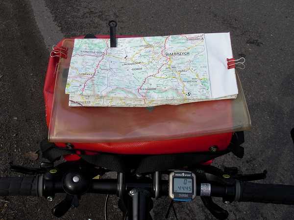
Cockpit |
Friday, 29.10. Karpacz
(Krummhübel), 70 km
At breakfast I get known to a waiter who is willing to speak out what
he thinks about the new membership of Poland to the European Union.
All of his declarations are accompanied by declining gestures.
The main problem is, that the western corporate groups (Lidl, Media Markt, Aldi Schlecker...)
will replace the smaller local companies and establishments. So to be
seen with the breweries which are pressed by Danish or Dutch
competitors (Tuborg, Carlsberg).
And so the fees drop and the unemployment is in advance. He gets more
and more excited and I am glad as I have finished my breakfast because
I am not responsible for this and cannot change it.
The end of this cycle tour is now in sight. You will know what I will
do? The only thing is, to find out the location of the Schneekoppe
(Snietzka) and a village nearby. And this is no problem, after just a
day's ride I should find what I want.
Boguszow Gorce (Gottesberg) 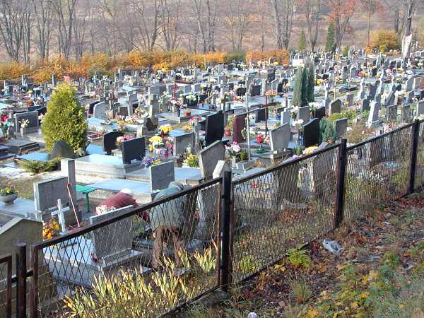
Cemetery |
We start at Waldenburg on a main road to the town Boguszow-Gorce
(Gottesberg). We see the relicts of the coal-mining activities, big
heaps of colliery excavations and winding towers now and then. We
wonder if the excavations beneath still exist and if the surface will
not break down one day.
|
I reach the fork of the side road where I want to enter the next long
drawn village. But there I see some people on their knees on the road
and a tank car across the street. I am glad that I have not to pass
this place and some minutes later hear the sirens of the ambulance, as
I stroll along the long drawn village which is named Witkow and then
Jaczkow, and the creek is named Lesk. This flows to the river Bobr. And
there is a valley which is one of the highlights of this tour. Of
course the weather with sunshine makes things bright and colourful.
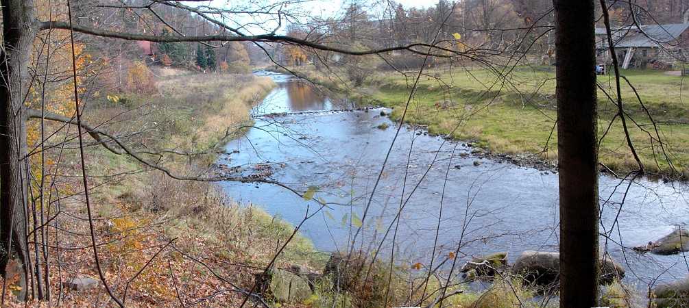
Im Bobr-Tal |
What's about the river Bobr?
We will learn:
The Bober (polish Bobr) has its
source at the Czech mountains and flows parallel to the Neisse towards
the north of Silesia. It finally meets the Oder. Its length is 268 km.
After the war the allied forces and the Russians disputed where to
locate the new borders they discussed about the Oder-Bobr-Line as well
as about the Oder-Neisse-Line and everybody knows which river got the
award and by that is well known all over the world.
Castle of Schildau |
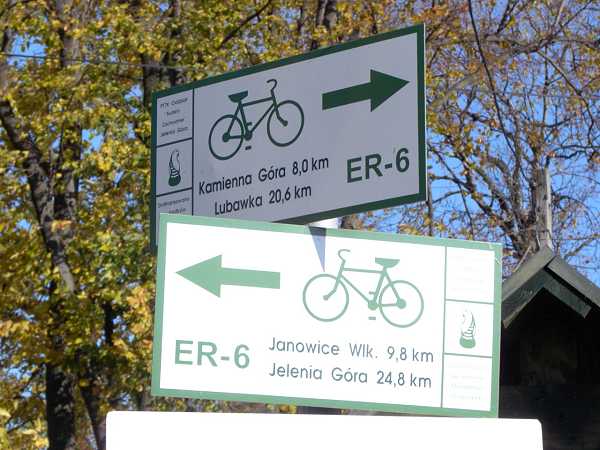
After some time I detect the signs of a long distance cycle path. This
is named ER-6 and we will
learn about it some time later. We come to the village Janowice Wielkie (Jannowitz). There
comes a cyclist on a mountain bike and asks where I will go. And it
turns out that we have the same aim and that is Karpacz. But he will choose the
shorter route via Karpniki
(Fischbach) while I prefer to stay to the rriver Bobr. I do very
hard to convince him that it is not obligatory to choose the shortest
route all the time. And there is so much time because it is not far
away.
So I admire the castle of Schildau where they restaurate and
rebuild until finally they have an exclusive hotel. At Myslakowitze
(Erdmannsdorf) I at last loose my orientation and find myself to ride
in a larger circle around the church. I pass a man in wheelchair twice
and he may wonder if I have a doubleganger.
The end for today is a long uphill until we reach the spatown Karpacz
at 600-800 m height. The former name of this place was Krummhübel and no one knows
how to translate Krummhübel to Karpacz. At the tourist information
they will not prefer any accommodation but there is a long list of
pensions and hotels. I should just ring at the next door they say.
Moreover I grasp an interesting brochure from the desk with the title
„Turystika rowerowa w Euroregionie Nysa“. And this is a description of
the cycle routes ER-1 to ER-7. The route ER-6 from this morning is
named "Dolny Bobru", is 100
km long and leads from Lubawka
(Liebau) via Kamienna Gora
(Landeshut) and Jelenia Gora
(Hirschberg) to Boloeslawice
(Bunzlau). There is another Cycleroute from Karpacz to Zittau
named ER-2 and this is just the rest of my tour. Let us see if we can
use this path.
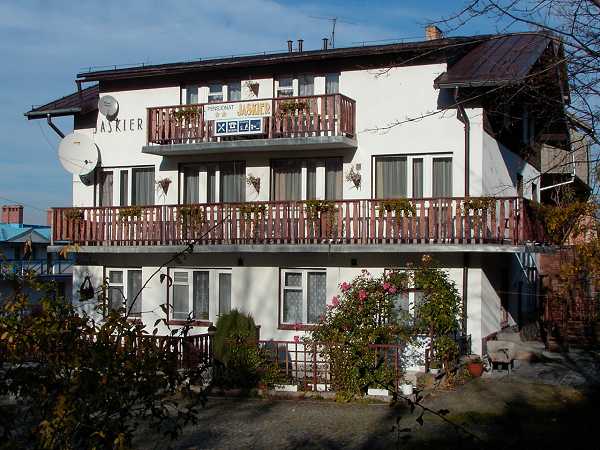
Pension Jaskier 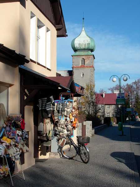
Karpacz 
Townhall |
As they told me I ring the bell at the next corner, the house is named
Pension Jaskier. A lady looks down from the balcony if there is someone
trustable at the front door. I say that I am a cyclist, want to
stay two nights and to climb the Schneekoppe tomorrow. This works and
some minutes later I stand at the window of my room and produce a
panorama of the park outside. Then a walk around in the sunshine and
let us hope that the weather keeps fine tomorrow. The spatown Karpacz
is fully touristically developped as the guests come mainly in
wintertime for skiing and wintersport activities. Let us hope that in
consideration of the New Europe they will not build any monster hotels.
View to the Park |
In the evening we meet at the Pizzeria
Verde. If you go early enough (6 pm) you are the only guest. At
about 8 pm the crowds come in, so then we get off and go "home" to mark
the route of today, write down this and that, think about tomorrow and
then watch some TV. It is a pity that we can have our brekafast not
earlier than 8 am, so an early morning attempt will not happen.
Saturday 30. 10., Schneekoppe 1602 m
After breakfast you see me climbing up the main street with my bike. I
want to ride as far as possible. I have choosen the route named
"Dr. M. Orlowicza". Just at the beginning there is an extremely bumpy
section, may be a historic paved path. The looming stones are as large
as a fist and it is impossible to ride. The camera jumps up and down in
the handle bar bag. After about 15 minutes we reach something big green
- may be it was a water tank. There is a tarmac road again (Olimpijskaja) and we could have had
an easier way to this place. Near the Hotel
Orlinek with the ski jump the actual ascent starts with a slight
uphill forest path which is properly ridable. It leads in a wide bend
around the valleys with the springs of the creeks Bystrzyk and Wilczy Potok. On this side of the
Schneekoppe there are two other springs, one is named Lomnica and the
other Lomniczka and what does this mean? (The first is the Lomnica and the second the pet name
"Small Lomnica").
Melzergrundbaude 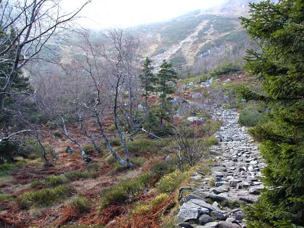
Melzergrund 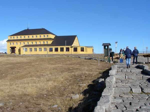
Untere Snetzkabaude 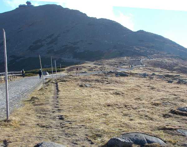
Zickzackweg |
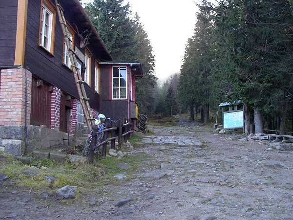
At the last creek there is the Schr. Nad Lomniczka and the German name was Melzergrundbaude, 1000 m high. We must leave the bicycle behind now because the path gets too bumpy. The path is thoroughly built and at some sections one could ride a baby carriage. So it is not so adventurous but I have goosebumps and I will tell you why.
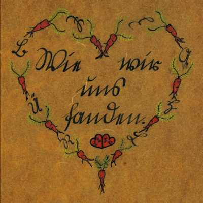 From the early fourties there
exists a Calligraphy booklet entitled "Wie wir uns fanden" (How we
found each other). The story tells about the days as my mother and my
father eventually fell in love to each other during a one-week vacancy
at Petzer, Pec today. This was on the other (Czech) side of the
Schneekoppe. The booklet is today part of my collection of ancestry
documents. And today I am in this area where - if you want to see
it like this - my origin or roots come from. May be you
understand my goosebumps now?
From the early fourties there
exists a Calligraphy booklet entitled "Wie wir uns fanden" (How we
found each other). The story tells about the days as my mother and my
father eventually fell in love to each other during a one-week vacancy
at Petzer, Pec today. This was on the other (Czech) side of the
Schneekoppe. The booklet is today part of my collection of ancestry
documents. And today I am in this area where - if you want to see
it like this - my origin or roots come from. May be you
understand my goosebumps now?
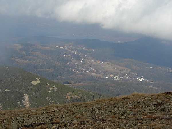
The ascent gets more and more wild and romantic as we reach the
treeline.To the left there is a big slope with the ridge of the
Schneekoppe on the top. We cannot imagine that we will get up there
today. Then there is a creek and no bridge. But today there are few
waters, may be this will be a problem at another day. We then zigzag up
the slope. At a group of rocks they have clipped memorial plates to the
rocks to remember former accidents with mortal result. Some are even
from the Himalaya (Annapurna). At the top we reach the Schr. Pod
Sniezka, 1394 m. Suddenly crowds of people are around here.
A sportsman runs to and fro, may be this is some kind of height
training with public attendance. The other people seem to have come up
here by a cablecar, there are even a lot of small children. All these
masses now press to the hedged zizag course up to the summit. It looks
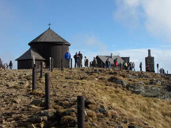
like an ant's trail. At the summit there is an ultramodern
meteorological station and even more crowds which could have come up
from the other side. I do some calculations: if there are 5
people around you within one minute these would be 300 in one
hour and 3000 all over the day. May be the goosebumps have gone
meanwhile.
Another information concerning
the crowds:
The Karkonoski National Park and the
Schneekoppe are visited by 1,5 million tourists the year. The touristic
structure is built by 112 km hike trails, 10 liftsystems and 12 mountain
cottages. The best period to hike in the Karkonoski is from May to
October.
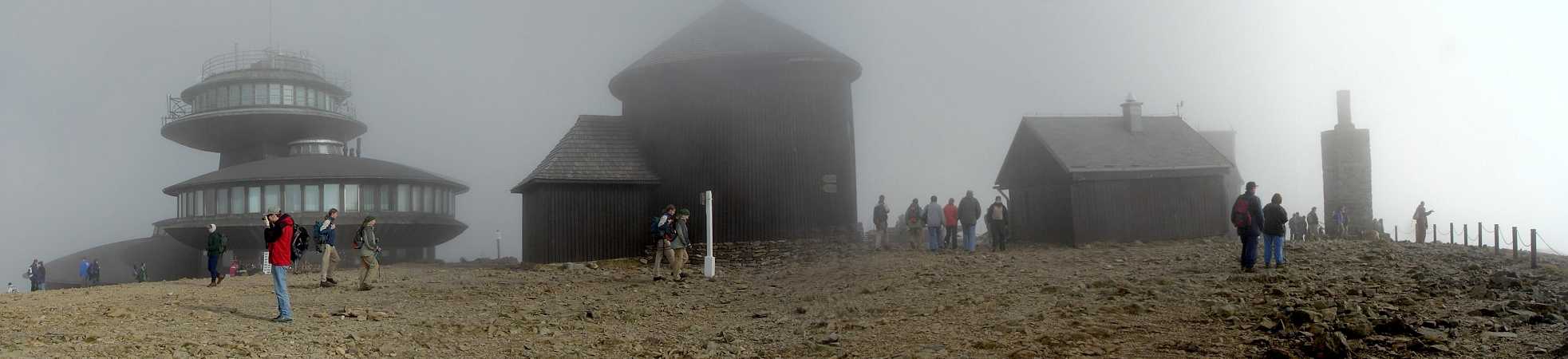
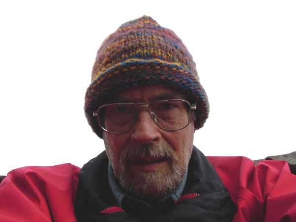
Summit of the Schneekoppe |
I cannot enjoy the famous view, ragged clouds chase over the plateau.
Sometimes we can look down and see a lake, woods or a village. But then
the picture disappears again and thereafter may be some sunshine. I sit
on the ground to make a photo for a good friend. She had knitted a cap
or bonnet for me as a gift for my last birthday. She was in doubt that
I would really be willing to wear this cap. So I think it would be the
best proof to have a photo from the Schneekoppe with the cap on my
head. But as I sit there, the camera turned to my face and as I try to
grin to the camera I feel pretty foolish and imagine what the observers
may think of that vain (eitel) guy. But the bonnet - that is pretty
warm.
|
We start for the descent along the busy zizag path. There is another path named Jubiläumsweg. This leads along the slope and is not so interesting. As we have left the Pod Sniezka behind and enter the Melzergrund we can feel more individual again. I come back to my bike which has waited patiently.
Karpacz 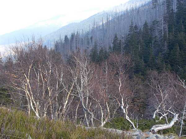
Melzergrund 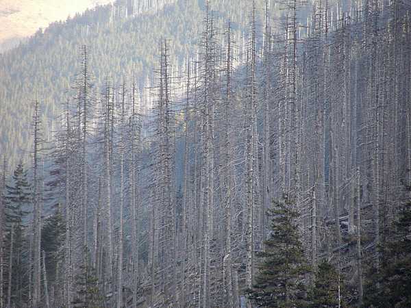
Tote Fichten |
The downhill to Karpacz is done in some
minutes and I am back in the early afternoon. So there is an occasion
for an unusual action and this is a nap in the afternoon.
In the evening you find me at the pizzeria next of that of yesterday.
There is a strange song from the music box: "We're all living in
America, Coca Cola wunderbar“ – there one can only gnash one's teeth
and if the result of the elections for the next president next week had
been known already one would have gnashed even more.
Sunday, 31.10. Zittau, 112 km
Today we will have the last section. And today they have changed from
summer- to winter-time and that means the clock is one hour earlier.
And it means, that if you had your breakfast at 9 am it really would be
10 am. And that would be too late for a 100 km stage. So I paid
yesterday and for today I get a lunch package instead of the breakfast.
It hangs at the handle bar as I start in the grey of the morning.
If you will not go to the main street you can only leave Karpacz if
you climb another 200 m up to 800 m height. Moreover there is this
mysterious ER-2 cycle path for all the way to Zittau. At the downhill on
the other side of the summit in full speed I miss the junction where
the ER-2 may lead into the woods. But as we pass some dozy villages we
soon meet the sign again. At a poster site in the botany I find a
poster with the offer to ride by bus to Cologne and other German towns.
Restplace 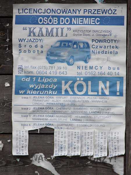
Anyone wants to go to Cologne? 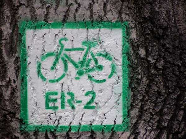
Sign of the Cyclepath |
It is enjoyable to ride here But then the ER-2 gets its victim. The
path is so bumpy that one only can push the bike. Then there are
endless uphills in the forests and on bumpy surface down again. I need
nearly 1 hour for 10 km and that is too slow. At last we meet civilised
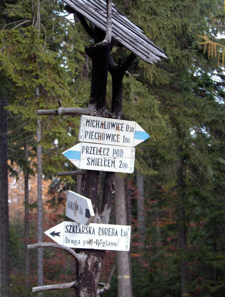
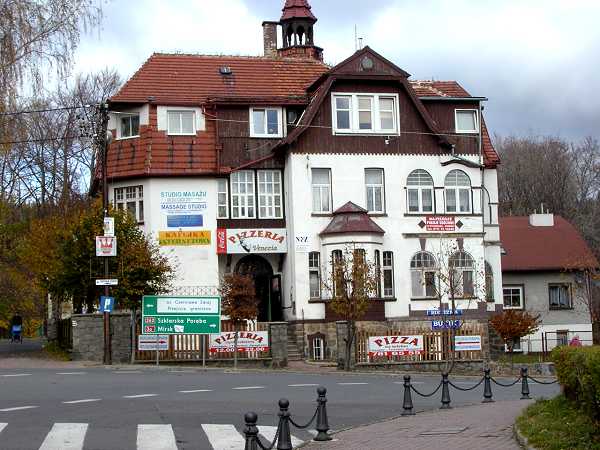
regions at Szklarska Poreba
(Schreiberhau), another touristic town. I turn back to the road,
the cycle path is too uncertain.
|
Now we must overcome the last serious uphill, but than we have a beautiful slight downhill road. Once I ride 5 km without pedalling with a speed of 45 km/h. This is rather funny and suddenly we are at Swieradow Zdroj (Bad Flinsberg), the last town near the Czech border. We have some last views to the mountains, which are named Isergebirge now. At the border to the Czech Republic they will have a look at my passport and put it into a scanner. But my attempt to ride without light in their country at the first day is not recorded - so they let me in.
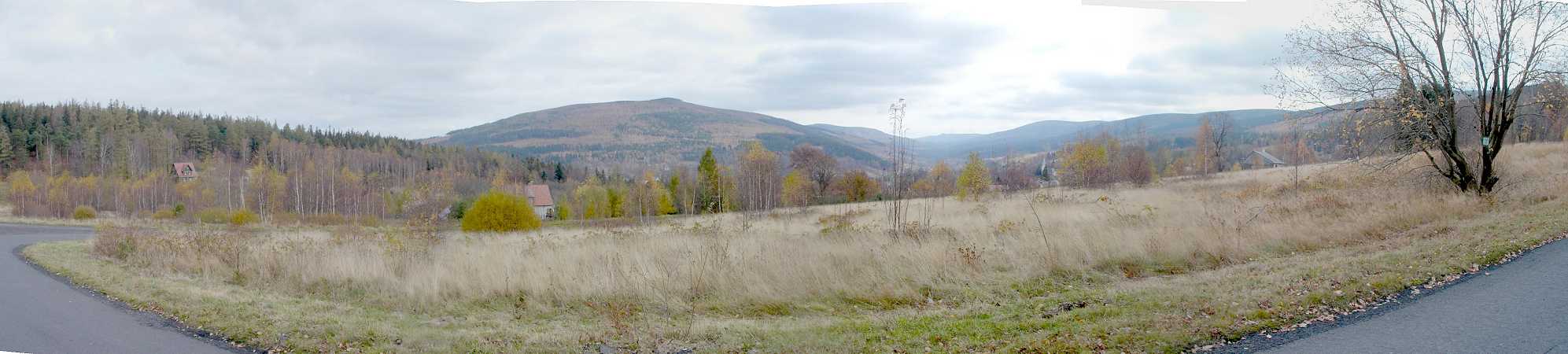
Near Swieradow Zdroj 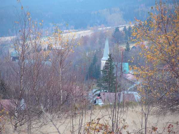
|
We then reach Nove Mesto, there is a fine square market but nothing else
to be seen. One should go for a detour now and visit the town Hejnice (Heinichen) with a baroque
cloister cathedral. But I had seen so much so better enter the road to Frydlant, which is not so
interesting. But then I find another detour and go right on a side
street to the last long village named Krasny
Les (Schönwald). So I reach Frydlant and have a nice rest
on the market place. This is very nice with the restaurated fassades of
the houses. And I get quite individually a carillon concert from the
tower of the market hall. We just have 1 pm.
Frydlant 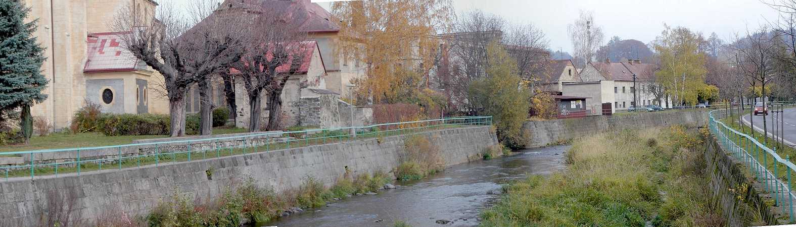
Frydlant |
We soon hit the next border, this time back to Poland. There are the
wide areas of the brown coal surface mining. It is too hazy now to get
a photo document of this matter. Then the road is marked green which
means scenic. May be this is true. I have a rest in a village name Opolno Zdroj (Bad Oppelsdorf). I
sit at the ground at the church and look to my map, 10 km still to go.
Then a man comes up and stops to have a chat. If I would be OK, or if I
would need something, water or so? Very kind of him, but I am
definitely OK and have no problems. May be it does not look so after
about a 100 km. He then tells me this and that about his village. It is
hard to understand because his German is so lousy.
I have found:
Bad Oppelsdorf (Opolno Zdroj) was an
established spa village. After the discovery of brimstone springs
(Schwefelquellen) during the 19th century a modern spa village was
founded and busy cure activities started. Taday Oppelsdorf is a shadow
of itself compared to earlier times. Moreover the village and its
region around may be used by future brown coal surface mining...
We roll the last km to the border. There is the obligatory Polish
cheap-market and we can "paint the town red" (phrase from the dictionary)
with our last Zloties. At the border control to Germany the adventure
"New Europe" finds its end. So in consequence I totally miss the town
of Zittau because the dam of the Neisse is so inviting. As I start to
get uncertain about the direction I really have reached the Dreiländereck (Border Triangle).
There is a rest station for cyclists and some signs about cycle paths
of the region, some lead across borders or say multilateral.
Let us roll out, back to Zittau, to the railway station for the ticket
for tomorrow and the to then Hotel
Dreiländereck where I was twice until now and will enjoy to
come again this time. Of course we pay more now than in the New Europe regions.
The restaurant Klosterstübl where we have been in 2001 is closed.
But there is another traditional pub: the Historisches Wirtshaus. There I
have smoked pork chop and curly kale (Grünkohl). In the background
we hear some music like „All
I need is the air that I breathe“ (Hollies) or „I did it my way“ (Sinatra). That's just
what I think.
On the way back I see the pizzeria at the other side of the street and
this is crowded. But I think we had really enough pizzas on this tour.
So let us think about it. The best of all was the weather and the
colours of the autumnal landscape. So we had a real "Golden October".
The accommodations were all OK and the more elegant hotels were first
class. Riding on side roads is enjoyable and the main routes are not so
good. But this is the case in all countries. The fact that I didn't
meet any other tourers shows, that cycling in Czech and Poland is not
so common yet. What a pity! May be next time we meet us on the road?